Mt Glasgow via East Ridge Scramble on 7-Jul-2019
We arrived at the Little Elbow Trailhead parking area at 07:30 and began our trip to Mount Glasgow in sunshine and blue sky.
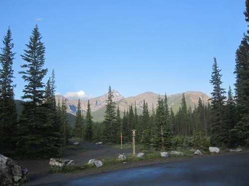
Mount Glasgow under blue skies (photo courtesy Ulli)
After crossing the suspension bridge, we turned right and soon left the trail to find the more obscure cutline trail taking us in a direct SW approach to Glasgow Creek.
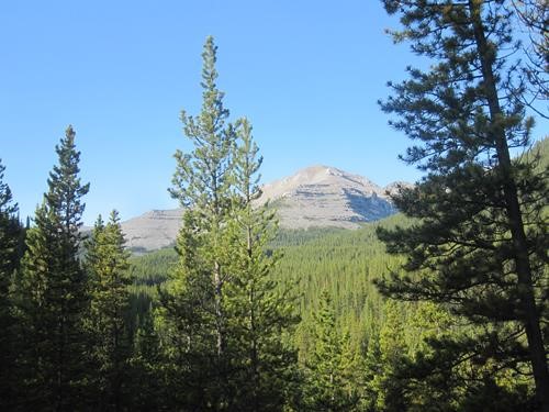
First glimpse of Glasgow's east outlier (photo courtesy Ulli)
After dropping down to the dry creek bed, we soon left it and followed a main trail south through a moist meadow marking the start of our ascent route up the NE ridge of Glasgow’s east outlier.
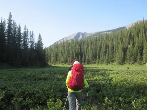
The meadow below east outlier (photo courtesy Ulli)
So, we turned west and commenced our off-trail and frequently bushy ascent to treeline.
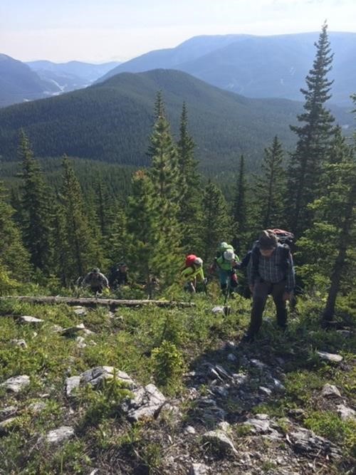
End of bushwhacking at treeline
From there, easy scrambling and hiking brought us to our first summit with expansive views all around and plenty to see.
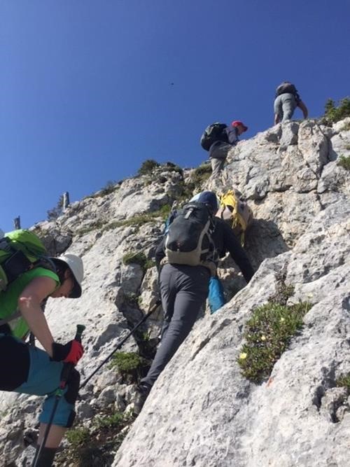
Hiking and easy scrambling begin above treeline
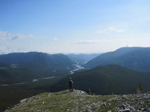
View to the east from Glasgow's east outlier (photo courtesy Ulli)
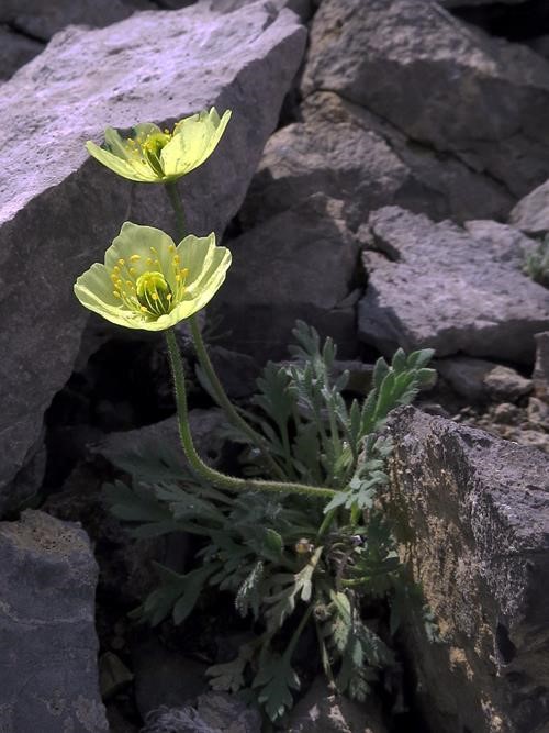
Alpine Poppy (photo courtesy Bill)
This is about the time we started hearing thunder in the distance and could see clouds rolling in from the west, which had us concerned.
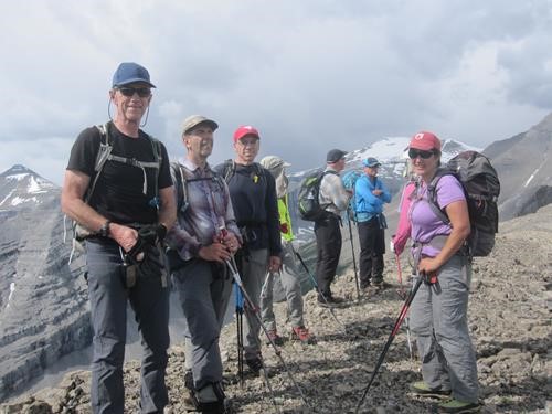
On the first summit hearing thunder (photo courtesy Ulli)
By the time we descended west to the col shortly after 11:00, it became apparent that a storm was imminent, so we sought shelter behind a rock outcropping to minimize our exposure to the cold wind and rain.
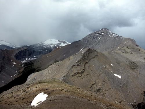
Descent to the col with brooding storm clouds (photo courtesy Bill)
We had an early lunch there, viewing our possible escape route from the col via a scree slope heading north down into the valley, as we patiently hunkered down contemplating our next decision – bail or continue. Fortunately, in less than half an hour we started to see small patches of blue sky appear to the west, that continued to grow as the storm moved past us to the east. The growing beautiful blue above us made the decision an easy one - forge ahead westward towards the summit.
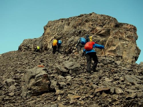
Leaving the col after storm passes (photo courtesy Bill)
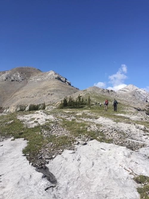
Ridge walk towards Glasgow
The long ridge walk was an interesting mix of scree, slab, pinnacles, and continuous views in all directions.
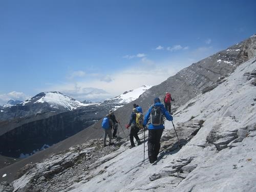
Encountering slabs (photo courtesy Ulli)
The more challenging terrain was usually easily bypassed on the left until the crux leading up the summit block.
In this case, going too far left meant precariously stepping on scree-covered slab. The better option was to scramble directly up the near-vertical rock from the left, followed by an easy walk to the summit proper. Once on top the views were amazing, but the previously blue skies were giving way to another band of threatening clouds.
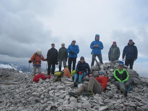
On Glasgow summit (photo courtesy Ulli)
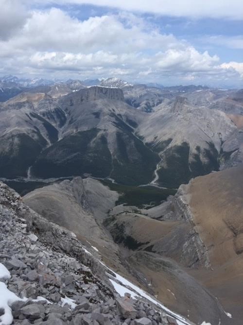
View of Romulus & Remus to the north
After all 11 Ramblers arrived at the summit and had enough time to rest and refuel, we headed back down the way we came. After downclimbing through the summit block, the clouds started dissipating again and we relaxed in the sunshine, grateful not to be pummelled by another storm.
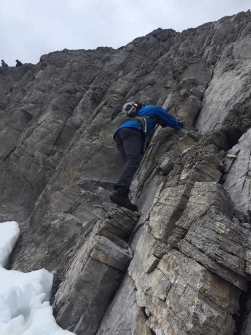
Bruce descending the crux
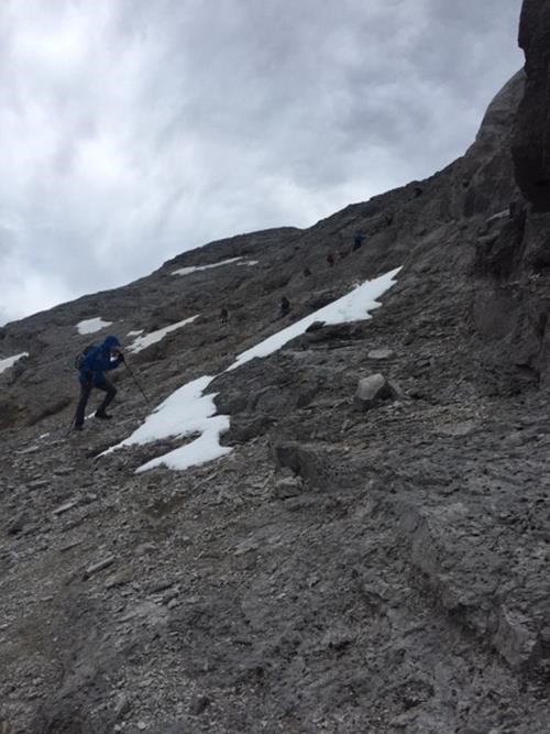
Alternate crux descent off summit block
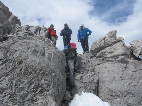
More downclimbing along the ridge (photo courtesy Ulli)
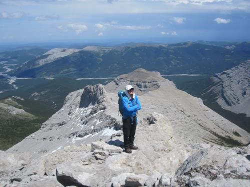
Ricardo enjoying sunshine on the ridge (photo courtesy Ulli)
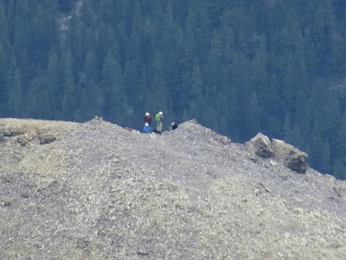
Another group of Ramblers on ridge to the north (photo courtesy Bill)
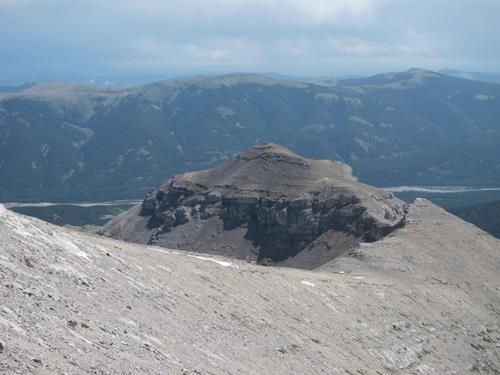
East outlier with Forgetmenot ridge behind (photo courtesy Bill)
We made our way down to the col and decided as a group to descend the scree slope into Glasgow Creek valley rather than clamber back up the east outlier and return the way we came.
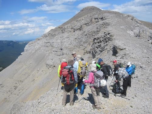
Contemplating the scree bash down (photo courtesy Ulli)
We took slightly different routes down, some donned helmets, looking for smaller brown rocks to make the scree run more pleasant.
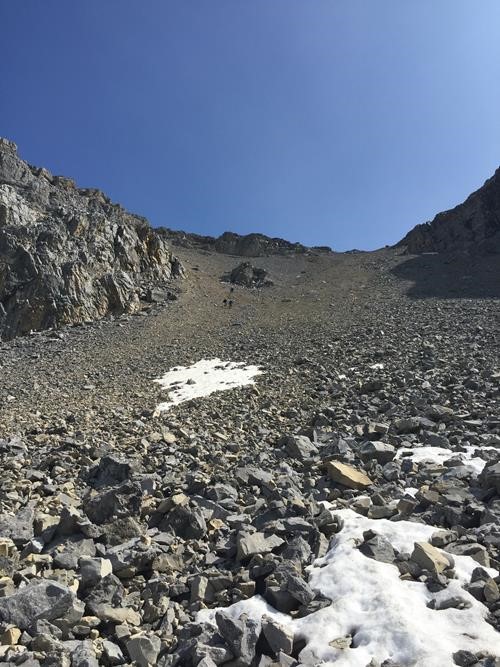
Scree bash
Unfortunately, due to the size of the group, some larger rocks were dislodged and began rolling down towards those further ahead. Communication was generally good to warn of the danger and, though nobody was hurt, there were some close calls. Later we discussed lessons learned as a group and determined that, coming down this slope with a large group like ours, it would have been better for all to wear helmets, spread out more if possible, and descend in 2 smaller groups in succession. After regrouping in the valley, we followed game trails and light bushwhacking on the north side of the dry creek bed, to take us eastward down the valley, avoiding tedious rock-hopping in the creek. Further down, we crossed the creek a few times until we found our main trail and retraced our steps back to the cars. This Spirko route up Glasgow was new to everybody on the trip and ended up being a fun, albeit long, adventure. The total trip was 11 hours, close to 20 km with 1,400 m elevation gain.
My thanks to the great spirit and patience of all participants: Sim,Bill,Arnold,Ricardo,Alda,Hannah,Bruce,Ulrike,Gary,Simon, for joining me, Brian, coordinator and scribe.