Entrance Ridges (John Ware Ridge) Snowshoeing on 13-Feb-2011
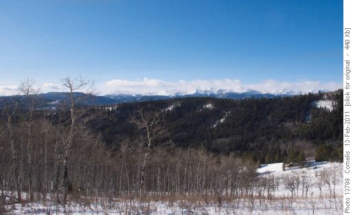
The day brought brilliant-blue skies. We started out from the trailhead at the Kananaskis sign at 9:15AM (~1,390m elevation), climbed up to the Kananaskis Fence-line and slid down the steep slope through deep snow to the valley below. The valley was also filled with knee-deep snow. We ascended the ridge West of Carey Ridge, following a gentle “fold” up onto the Ridge-line West of Carey Ridge. Snow-cover on the ridge was reasonable, with a few deeper & soft patches. We followed this ridge up to its summit at NAD83 11U 678022 / 5615901 (~1,580m elevation). The views West to the Front Ranges were magnificent.

View west onto the Front Ranges from the Ridge West of Carey Ridges (Entrance Ridges, Kananaskis Country)

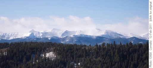
Front Ranges, "smoking" snow in the strong winds, as seen from the ridge west of Carey Ridge.A little North of the summit, the treed slope (aspen) is relatively free of shrubs down to the valley floor. The steep slope down to the valley floor was covered in knee-deep snow, through which we partly slid down on our snow-shoes. Once down, you have to hike SE along the valley floor (~1,463m elevation, large fir trees, cattle trail) to the saddle (~1,494m elevation), from where you get a good view up the easy slope unto Carey Ridge, with not too much snow. We took a lunch break as soon as we reached the Carey ridge-line at noon, enjoying the sun and view. Cornelis often hiked this ridge over the past 10 winters, and snow-cover on the ridge was exceptionally deep today, without a weight-bearing crust, forcing us to “wade” through the loose snow on our snowshoes (usually the chinook scours this ridge virtually free of snow). After lunch, we continued 1.8km North to Carey Ridge summit (~1,540m elevation) to the large fir on Carey Ridge (11U 677582 / 5617582 ~1,450m elevation), where we took the group-picture.

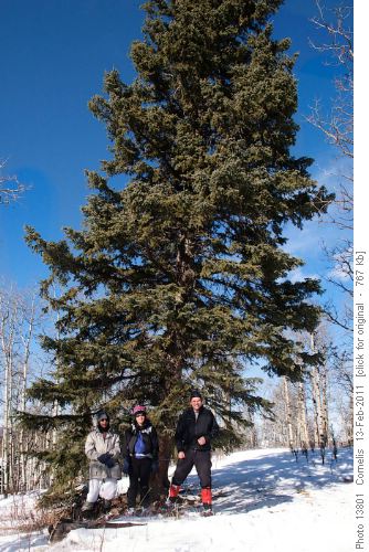
Ghulam, Sharon and Cornelis at the magnificent Fir Tree on Carey Ridge (NAD83 11U 677582 / 5617582 ~1,450m elevation).We decided not to continue beyond the Fir Tree down the to the next valley to ascend John Ware Ridge to the East, due to the deep snow and the fact that this valley usually packs the most snow. At 1PM, we started back South on the Carey Ridge, hiking past our lunch-spot. Approximately 500m South of our lunch-spot the deep snow relented; the wind had scoured the last 800m to the fence (11U 679298 / 5614943, ~1,394m elevation). We descended down along the fence into the valley, and ended up in very heavy and weak knee-deep snow, slowing us down to 1.5km/h for the next 1km. We made our way up the steep slope we came down that morning (45m vertical) in deep, weak snow. With some relief we descended to our car; back at 3:40PM. Hiked distance for the day: 12km. Ghulam and Sharon, thanks for joining me on this magnificent, be it a bit challenging day! Cornelis, coordinator & pictures.


