Yarrow Creek Basin backpack Off-Trail Hike on 18-Jun-2005
At 5:00 am on a rainy Calgary morning, two brave Ramblers joined the coordinator in a dark, wet parking lot and prepared to set out for anywhere with even a slight chance of sunshine. We had planned to backpack in the Cline River area west of Nordegg but were dissuaded by forecasts of torrential rainfall and flooding waterways. Rumour had it that sunshine was expected in the Waterton area so we started heading south. After a 5:30 am coffee stop at the Cinnamon Spoon in Bragg Creek, we continued on our journey and encountered our first detour, Hwy 762 was flooded and closed between Bragg Creek and Millarville. Continuing eastward on Hwy 22, we came upon a bridge with the stream running over the bridge's deck but were able to continue thanks to our high clearance vehicle. At this point we were warned that Hwy 22 south to Turner Valley was closed at Millarville due to flooding. With no other choice we proceeded on to Hwy 2 before continuing south. Fortunately, we were able to find an open connecting road to Hwy 22 and were able to get back on our chosen route just south of Longview, with only one short detour.
By 8:00 am we were at the Pincher Creek turnoff with ravenous appetites that had to be satisfied. A huge cowboy style breakfast washed down with gallons of coffee soon had us filled up and on our way. It was at this point that the final decision to backpack into Yarrow Creek was made. I had visited Yarrow Creek last year on the July long weekend and knew we could expect a beautiful site with excellent camping and a scenic hike into the area. The Yarrow Creek valley borders on the north boundary of Waterton Lakes National Park and is accessed by a combination of township and wellsite roads. When we got to the trailhead the sun was shining but the wind was howling. We got ourselves organized and were on the trail by 10:00 am. The first part of the route is on a well defined trail along a continuation of the township road allowance. The trail might be well defined but it was also wet, muddy and featured a lot of ascents and descents. The trail soon drops down to creekside and follows Yarrow Creek until it intersects with the wellsite road.
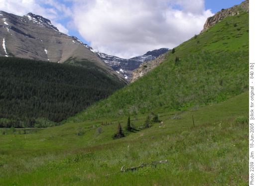
Yarrow Creek trail before it intersects with the wellsite road.The next three km is along the wellsite road and is the least interesting part of the entire trip. By noon we were at the end of the road and we stopped for lunch before continuing on.
The trail from the end of the road to the end of the valley is along an old overgrown exploration road that run high above the north bank of Yarrow Creek. The Yarrow Creek valley is quite narrow and the mountains on both sides tower above you. It is an incredibly beautiful valley - the stream with its many waterfalls courses below you while rock and snow loom above.
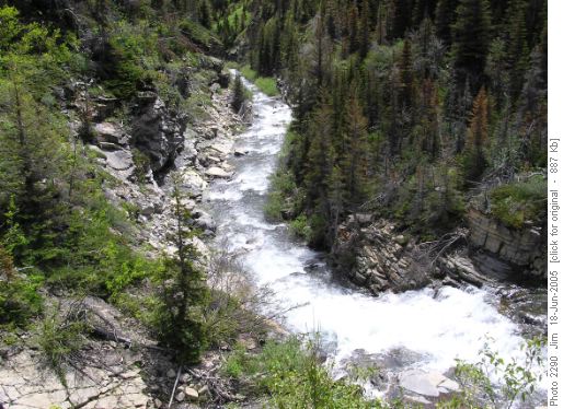
Yarrow Creek offers an abundance of waterfalls and many scenic overviews.Add some blue sky and the scene is close to perfect. The six km of trail from the end of the road to the campsite in Yarrow Basin is a continuous uphill grind but the scenery makes the effort more than worthwhile and your first view of Yarrow Lake is a fitting reward.
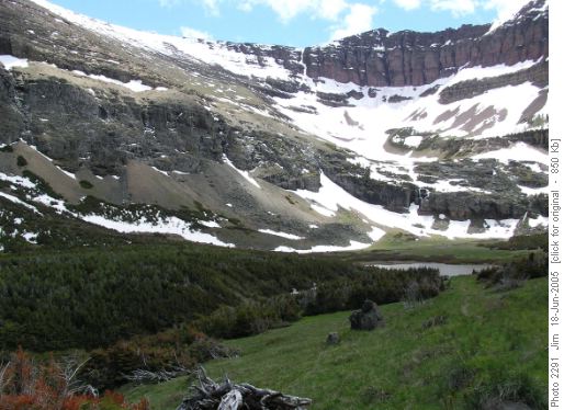
Yarrow Lake nestled beneath a snow covered Newman Peak.By 4:00 pm we were at our destination, a beautiful campsite at the end of the valley and at the foot of a cascading waterfall.
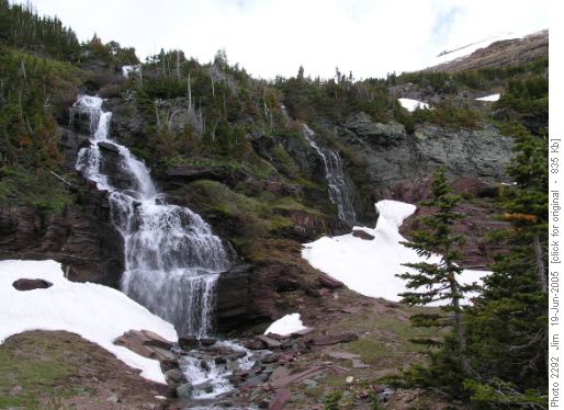
Upper Yarrow Creek Falls.We soon had our camp set up, a couple of tents, an ultralight backpacking hammock and our camp mascot - Pinky, an inflatable pink flamingo, when we first noticed that we were not alone.
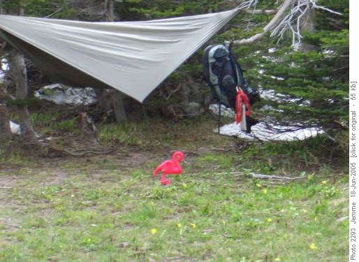
Pinky standing guard over our peaceful Yarrow Basin campsite.The biggest and most aggressive marmot that any of us had ever seen, marched into our midst and made it abundantly clear that we were not welcome in his corner of the Yarrow Basin. This marmot started to throw his weight around and attacked everything in sight. He went after tent pegs and guylines in an effort to tear down our tents. Only the hammock, hanging safely above the ground was safe from attack. However our camp mascot Pinky was soon victimized by an unprovoked attack by this vicious aggressor and had to be rescued by a timely intervention from the coordinator.
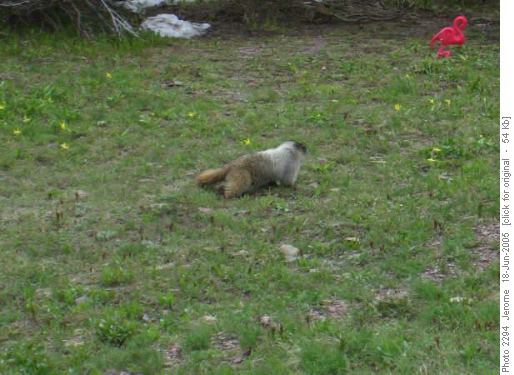
Horrors! The manic marmot has his sights set on Pinky! This hyper-aggressive marmot even enlisted a couple of willing ground squirrels as accomplices in his efforts to drive us out of his domain. Strangely enough, when we left the immediate area of the tents and retired to the cooking area, the marmot ceased his relentless attack and was never seen again.
Dinner around a roaring campfire was a most pleasant way to end the day, with the warmth from the fire warding off the evening's chill. When the rain began to fall in earnest, we snuffed out the fire and retired to our respective shelters where we were buffeted by torrential downpour and gale force winds for the entire night. Cloudy skies and moderate wind welcomed us in the morning and a look at the weathered-in ridge above us chased away any thoughts of an ascent to the ridge. After a hearty breakfast we packed up and were headed back to the trailhead by 11:00 am, under sunshine and clear skies.
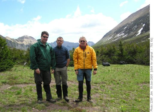
Mark, Jerome and Jim in Yarrow Basin before heading back tot the trailhead. At noon we stopped for lunch beside one of the prettier waterfalls on Yarrow Creek and then explored a couple of the fords that cross Yarrow Creek. These fords allow access to one of the side valleys that lead to Mount Glendowan. Later in the summer these fords might be passable but on this day high, fast water made the fords impossible. By 3:00 pm we were back at our vehicle and heading back towards Pincher Creek. On the way we took advantage of our high-clearance 4WD truck and explored a 4WD track into Boivin Lake in the South Drywood Creek valley. We stopped at Luigi's in Pincher Creek for a well earned dinner before continuing the drive to Calgary. We back in the city by 10:00 pm, tired but satisfied with our Southern Alberta escape from Calgary's rainy weekend.
Participants: Mark; Jerome. Coordinator, photographer & scribe: Jim.
Trip Statistics: Day 1, Distance - 12.9 km; Elevation gain - 768 metres; Maximum elevation - 2005 metres; Time - 6 hours. Day 2, Distance - 12.9 km; Elevation gain - 299 metres; Maximum elevation - 2005 metres; Time - 4 hours.


