Waterton to West Castle backpack Scramble on 18-Aug-2015
RMRA: Waterton to Castle Mountain Ski Resort Backpack: 18-25 August 2015 by David
GDT Alternate route: 94 kms, about 6500 vertical metres, 57 hours. Accurate Kms and hours, approximate vertical metres. Reference: Hiking Canada’s Great Divide Trail by Dustin Lynx.
Day 1: Tuesday 18 Aug: Car pool in 2 cars to Castle Mtn Resort. Park one car, drive to Waterton town car campground, supper, pie & ice cream, free hot showers, bed. Two campsites @ $40 each site inc. $12 reservation fee. Four Ramblers (all coordinators): David, Ealaine, Celine and Manfred each with complete set of gear including tent, pot, stove, food (no sharing, by consensus). Pack weights each with about 14 lbs food: David – 36 lbs, Ealaine – 41 lbs, Celine – 42 lbs, Manfred – 50 lbs.
Day 2: Wednesday 19 Aug: Hike Carthew-Alderson Park trail to Cameron Lake, ice cream. Continue hiking to camp at Akamina Creek campsite in BC. Nice site but poor stream water. Sunny, hot, views, 22km, 1100m, 9.5 hrs.
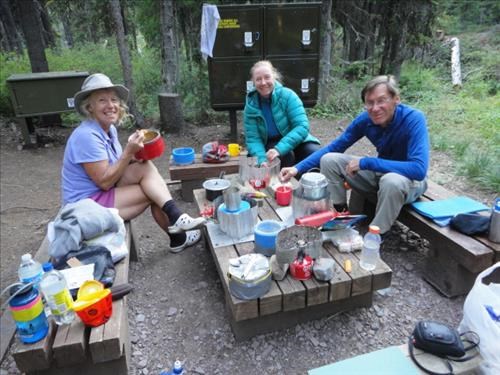
GDT: Supper at Akamina Creek Campsite, BC (near Waterton Park): Ealaine, Celine, Manfred
Day 3: Thursday 20 Aug: Steep rough ascent up BC/Alberta border cutline to Mt Rowe. Roughish ridge walking over Mt Festubert (2522m) and other “bumps” to camp in vicinity of South Kootenay Pass. Water from Blue Grouse Basin Lake. Hot, windy and smoky. 16km, 1600m, 11.5 hrs.
Day 4: Friday 21 Aug: Follow park trail in Alberta past Twin Lakes to Sage Pass. Varied roughish ridge walking to outfitters camp in meadow at Font Creek (a19) by 4.00pm. Fair smoky weather until 5.00pm, then wind and storm dropped temperature 10-15 degrees and 10 cms snow. “Saved” by absent outfitters huge tarp. A long cold snowy night. 12 km, 700m, 6 hrs.
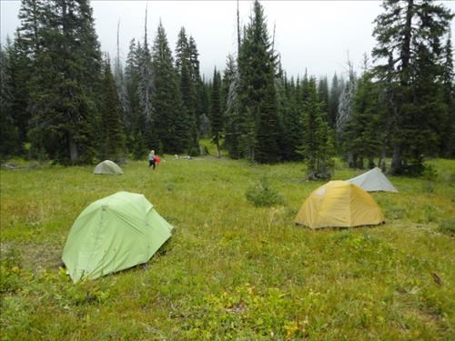
GDT: Font Creek Meadow campsite, AB, before the storm
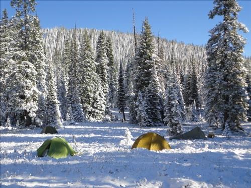
GDT: Font Creek Meadow campsite, AB after the storm
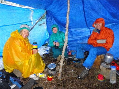
GDT: Supper at Font Creek Meadow campsite during snowstorm: Ealaine, Celine, Manfred
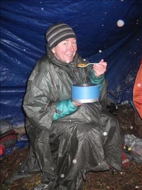
GDT: Celine enjoys supper at Font Creek Meadow campsite, AB, during an August snowstorm
Day 5: Saturday 22 Aug: Follow sketchy but fair GDT trail around Mts Font and Makin to rejoin ridge and random camp at head of pretty Scarpe Creek (a24). Bright and sunny with no smoke and rapidly melting wet snow. 9 km, 700m, 5 hrs. Wild Saturday night party into the early hours (just kidding!).
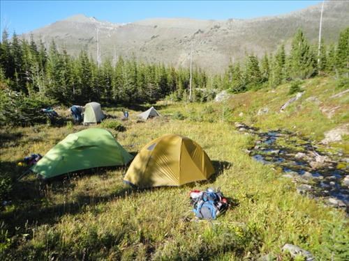
GDT: Scarpe Creek headwaters, AB
Day 6: Sunday 23 Aug: Hot, rough, windy, smoky ridge hiking on Dustin’s Alternate route over 7 “bumps” including Mt La Coulotte (2438m) to camp at unnamed lake with informal campsite 2.5 km north of Ruby Lake. Spectacular long distance views obscured by smoke. 13km, 1400m, 11 hrs.
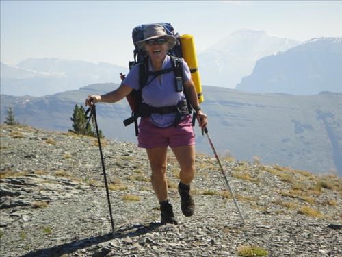
GDT: Ealaine backpacking on La Coulotte Ridge: Alberta/BC border
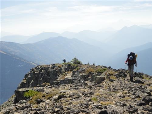
GDT: Manfred on La Coulotte Ridge: Alberta/BC border
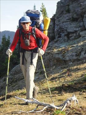
GDT Alternate: Manfred backpacking on South end of Barnaby Ridge, Alberta
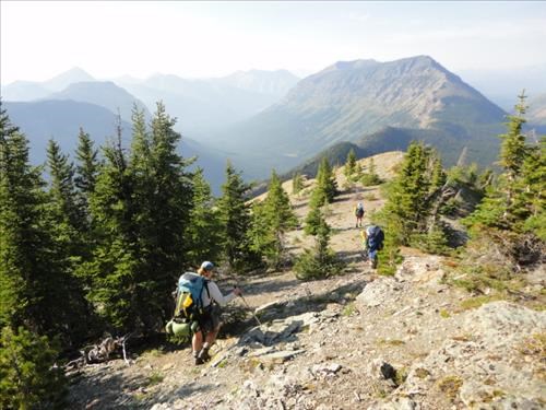
GDT Alternate: Ramblers backpacking on South end of Barnaby Ridge, Alberta
Day 7: Monday 24 Aug: Very rough treed ridge walking to 0.5km long scramble section with some exposure on Barnaby Ridge. One SC5 20m vertical ascent. Continued rough walking over several bumps, but gradually easing to a wide shale ridge ascent of Southfork Mountain (2330m). Weather was warm, windy but very smoky obscuring distant views (and sometimes the valley bottoms). Steep descent down open shale slopes to camp in small sites among tight trees at upper Southfork Lake out of the strong wind. Technically the hardest day and seldom done by other GDT hikers. 13km, 1000m, 11hrs.
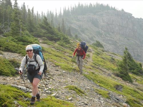
GDT Alternate: Celine and Manfred backpacking on South end of Barnaby Ridge, Alberta
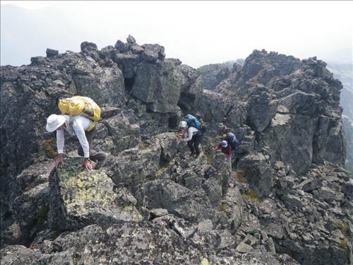
GDT Alternate: David, Celine and Manfred on scramble section of Barnaby Ridge, Alberta
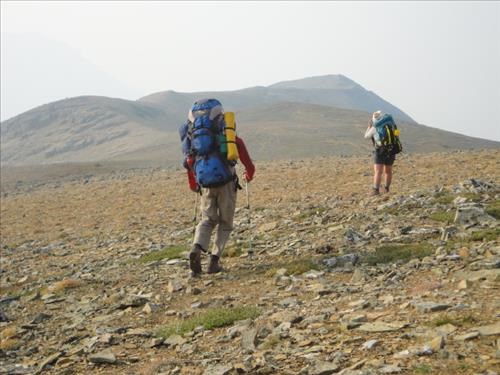
GDT Alternate: Manfred and Celine approach Southfork Mtn from south: Alberta
Day 8: Tuesday 25 Aug: Easy descent on improved trail around Southfork Lakes and down to highway 774 crossing the shallow Castle River on logs [lat 49.35027, long -114.41167] 2.5 km north of the Castle Mtn. ski hill. We actually met several fishermen walking up the trail, a couple car-camping with dogs by the Castle River and some U of C students conducting Ground Penetrating Radar field research in the Castle Resort parking lot. Weather continued hot, windy and smoky. (+30c at 3.00pm in Waterton). 6km, -400m, 2.5 hrs. Drive in one car to Waterton town campsite, free campsite hot shower, picnic lunch with liquid refreshment, drive 370km back to Calgary in 2 cars. Sleep in a bed (I did).
Comments: To me, this 90 km section of the GDT is the best ridge backpack that exists (and I have done a few in the past 50 years). Unfortunately extensive smoke from fires in Washington State ruined any long distance views and the wild snow storm was not welcome. Otherwise we had good warm weather with no mosquitos. Between Akamina Creek and highway 774 (5 days), we only met one couple (at Twin Lakes), saw little wildlife (no bears but bear prints were obvious near Font Mtn). Water sources dictated the day’s hiking and we usually had to carry the entire day’s supply. Route finding with map and occasional GPS was quite straightforward. The book’s descriptions were accurate and the occasional orange GDT blazes were appreciated.
I felt that we gelled well together. We hiked at roughly the same pace and complained of similar sore body parts (eg knees, back) which was probably a reflection of our ages which varied from low 50’s to low 70’s. While we had no major equipment malfunction, we worked around the minor ones (Manfred sewed a ripped pant leg, a stove quit, David’s shoe partially delaminated, someone forgot a meal). Thanks guys for a great trip: Ealaine, Celine, Manfred from C&S David.