Mt Burke Trail hike on 29-Jul-2020
It was a very hot and humid day and perhaps that is why our number had dwindled to 7 from 11, but we slogged up to the old lookout on the summit of Mount Burke in the unrelenting heat, only to look down on a trapped layer of smog and humidity held down by high pressure. The views of the mountains nearby were better than those out to the foothills and plains, which were just blah. I don't think anybody remembers such a calm day on the peak. There was just the occasional light breeze, but luckily the flies were not bad, unlike the infestation of flies and mosquitoes in the valleys. One bonus was that there was nobody else there, so we had the perfect social distancing. Five summited, but those who turned back shy of the top didn't miss a thing with the murky view.
We went up the "cutline" trail, with its brutal steep ascents and descents through dips, but just to check out something different on the way down, Harold showed us a Daffern trail which dropped down from the old lookout service trail to the Salter Creek valley. It had fewer undulations but followed the edge of the very high eroded bank in places, with some overhanging places and some places where the trail has already gone over the side. After a bit of river run boulder bashing we got back on the trail from the parking area.

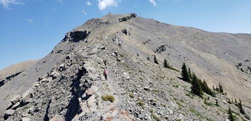
The final climb to the summit of Mount Burke

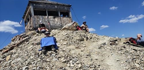
Lunch at the old lookout on the summit

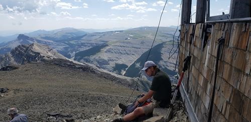
View of Plateau Mountain, Sentinel Peak and Saddle Mt. from lookout
Participants: Linda, Robert, Ron, Harold, Dean, Michael and Carl, coordinator and scribe.

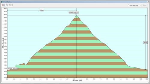
GPS elevation profile: Ascent Via Cutline, Descent Via Daffern's Route, Distance: 10.5 km, Hike Elevation Gain: 868m