Cat Creek Hills traverse Off-trail Hike on 3-Nov-2007
We dropped a shuttle car off at the Highwood Compound Recreation Area and started from the Cat Creek Recreation Area trailhead at 9:30AM (1,555m alt.), first visiting the Cat Creek Falls.
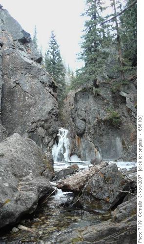
Cat Creek Falls Throughout the day, we saw swooping curtains of snow falling on the Rockies NW of us, interspersed with blotches of sunlight. We also saw sun on the lower foothills and Prairie to the South-East, but our patch of foothills stayed below clouds cover. Fortunately,the temperature remained above the zero degrees and the wind was not too strong.
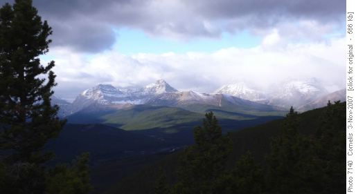
View on the Elk Range to the West From the footbridge at the Cat Creek Falls, we scrambled up the steep SE embankment to avoid a difficult creek-crossing further down-river. We ascended along old mining roads and later animal trails on the ridge. At 12:10 sat down for a 20-minute lunch-break on a sheltered grassy slope not far from the summit. From this vantage point, we had a good view on the Rockies. We reached the summit at 2,225m altitude at 12:50PM.
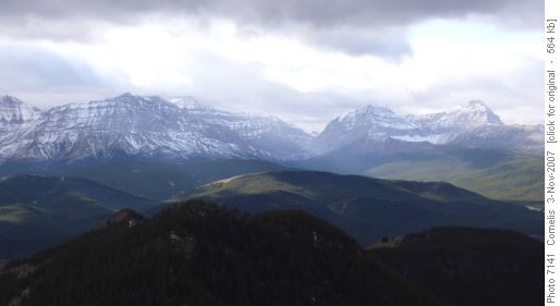
SW View from Cat Creek Hills Summit, Carnarvon Creek at centre
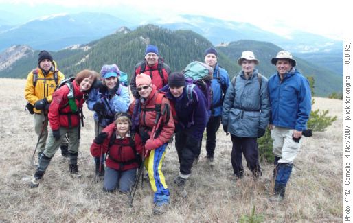
Ramblers on the Cat Creek Hills Summit - Official portrait.
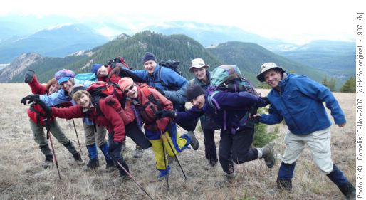
Ramblers on the Cat Creek Hills Summit - Unofficial portrait, enacting "Teapots with Little Spouts" On our descent from the Cat Creek Hills Summit to Junction Hill Pass (NE of Junction Hill Summit) we followed the ridge-line as long as possible. From the pass we followed a distinct trail below the Ridge Road to the viewpoint on the grassy ridge NE and just below the Pass. From there, we followed the ridge as long as possible to enjoy the view, finally bushwhacking (easy) to reach the Stony Creek, which flows through a deep canyon. We followed the westerly brow of the canyon, finally joining the regular trail approximately 700m before the highway at the Highwood Compound Recreation Area (1,514m altitude). We were back at the shuttle car at 3:10PM, after an enjoyable hike.
Trip Statistics: Distance: 13km. Elevation Gain: 670m. Total Elevation Gain: 790m (due to all the ups & downs). The satellite immage below shows the hike from Cat Creek Hills Recreation Area at the middle left (West), to the Highwood Compound Recreation area to the right hand bottom (SE). (The more westerly line follows the Junction Hill Ridge, which we did not take.)
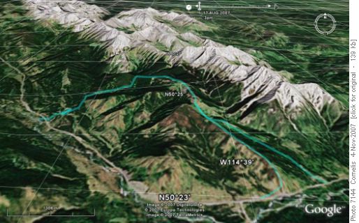
Cat Creek Hills; Highwood Range in the background. (Hike=blue line, return RH line through valley)Participants: Jean, Christine, Carolyn, Janet, Peter, Damian, Jim, Joe, Bob, Cornelis (Coordinator, Author, photographer).


