Following Raymond Patterson's Footsteps: backpack Off-Trail Hike on 8
It had been quite some time since the coordinator had last tried a personal exploratory trip using Gillean Daffern's vague and somewhat ambiguous trail descriptions. Thus, it had been some time since the coordinator had enjoyed the dubious pleasure of being 'Dafferned' (e.g. Route-finding wild goose chase resulting from trying to follow Daffernesque guide book instructions). But 'Dafferned' I was after mis-reading Gillean's instructions, taking a wrong turn and then trying to find trails that would take us back on route without actually admitting defeat and backtracking. Ramblers do hate to backtrack, and besides it wasn't mid-winter and -30 or anything like that. And can we really consider a hike to be a Rambler hike without a little bushwhacking. However, we were backpacking not hiking; carrying 40 lb packs; it was hot and dry; and we were bushwhacking through a 70 year old forest fire burn. Fortunately my companions on this trip had a sense of humour and a spirit of adventure; and they did sign up for an exploratory backpacking trip.
Prior to the bushwhacking we did enjoy a very pleasant fording through knee-deep water of the Highwood River.
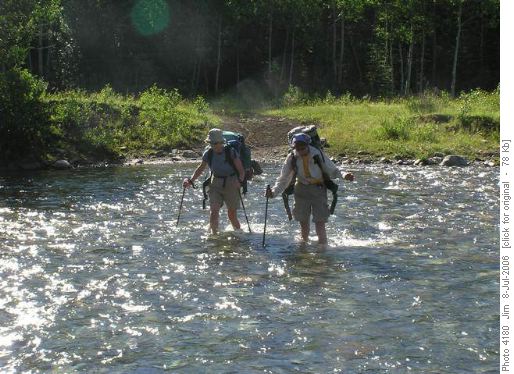
Ginger and Margaret fording the knee deep waters of the Highwood River And though the bushwhacking did add 3 km to the length of the first day's backpack we did arrive at our campsite at a reasonable hour, a direct result of leaving Calgary at 6:00 am and being on the trail by 8:30 am.
After a very pleasant evening at our campsite, completely protected from hoards of attacking blackflies and mosquitoes by our Bugamid, we were on the trail by 7:30 am and on our way to Weary Creek Gap. Beavers have completely taken over Weary Creek below the headwall and the basin is quite well flooded at this time of year. The flooding forces you to ignore Dafferne's instructions to follow the road to its end. Rather we were forced to start climbing to a grass covered bench somewhat earlier than you might have done in years past. However by climbing to the bench earlier we found it quite easy to pick up the old Elk trail up the headwall. From a distance the trail is almost impossible to see but once you are on it, it provides a quick, though steep, route to the top of the headwall and a gateway to the pleasures of the Weary Creek basin and Weary Creek Gap. The route we followed took us first to a col somewhat to the north of Weary Creek Gap and then to a rocky knoll that will always be 'Patterson Point' to me. I know Raymond Patterson would have idled away many hours on this knoll, savouring the views to the east, west and north west.
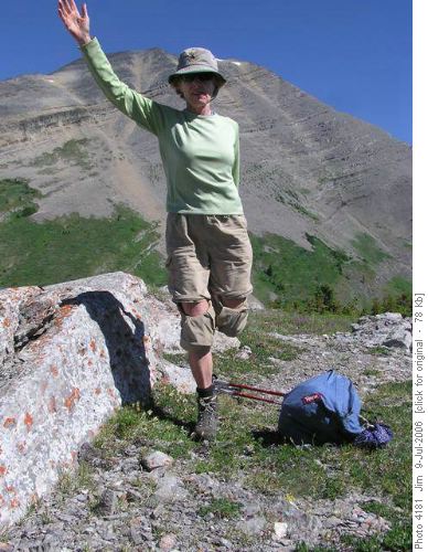
Ginger demonstrates a yoga stretch with Mount McPhail in the background
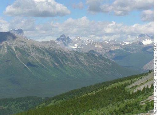
View to the northwest from Patterson Point
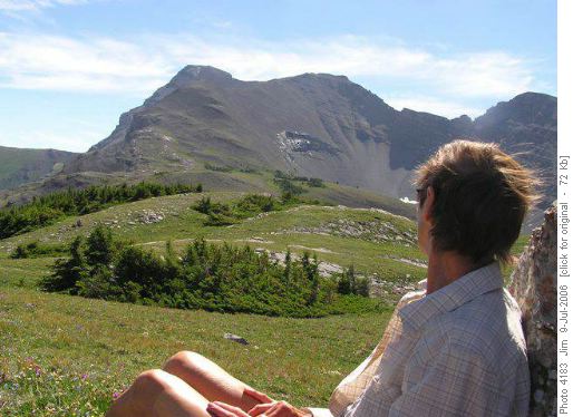
Margaret admires the view of Mount Muir from Patterson Point
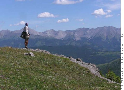
Margaret gazes east towards the Highwood Range After an extended and leisurely sojourn on 'Patterson Point" we made an easy descent down to Weary Creek Gap, picked up the trail and headed back to the tarn that feeds the Weary Creek Falls and the headwall. The trail around the south end of the tarn is somewhat indistinct and requires a tricky log crossing of one outlet stream;
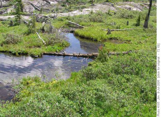
Log crossing at the south end of the tarn on the Weary Creek Gap trail an even trickier rockhopping crossing of another outlet stream;
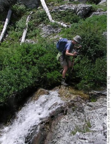
Ginger gingerly picks her way across the rocks at the south end of Weary Creek Gap tarn followed by a few scrambly steps across a rocky piece with good footing.
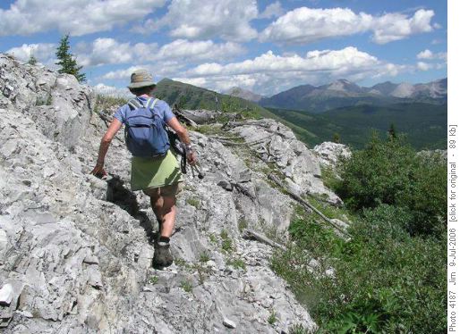
Like a pro, Ginger picks her way across a rocky feature on the Weary Creek Gap trail A cautious descent of the steep headwall trail brought us back onto the grassy bench
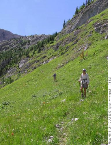
Margaret and Ginger navigate the Elk trail with the Weary Creek Gap headwall behind them where we followed the Elk trail to where it intersected with the trail to Lake of the Horns. The Elk trail is quite overgrown in places but still fairly easy to follow and proved to be a good route back to the Lake of the Horns trail which provided a direct route back to our campsite. Back in Camp by 2:00 pm we had our tents packed up, fresh water pumped and we were on the trail by 2:20 pm.
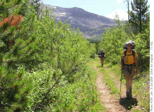
A weary Margaret and Ginger on the road home from Weary Creek Gap Cold wobbly pops, waiting in the cooler at the trailhead gave three tired Ramblers the will to forge ahead and we were savouring our first of the weekend by 6:45 pm. From the trailhead it was back to Longview for an exquisitely served gourmet meal at the Longview Steakhouse (Roast Pork Tenderloin /w a Tarragon Reduction Sauce served with salad, roast potatoes and seasonal veggies - ya gotta to try this place, next to the Esso, to believe the quality; the presentation; the service; and the overall value). We were back in Calgary by 10:00 pm; tired but satisfied with an excellent weekend; a fantastic destination; incredible company and a superlative trip ending meal.
My thanks to my backpacking companions for this trip: Ginger and Margaret. Thank you ladies, it was again my pleasure.
Trip statistics: Day 1 - Distance 13.5 km; Elevation gain 574 m; Maximum elevation 2019 m. Day 2 - Distance 21.5 km; Elevation gain 850 m; Maximum elevation 2306 m. Weekend - Distance 35 km; Elevation gain 1424 m; Maximum elevation 2306 m.
Coordinator, photographer & scribe: Jim


