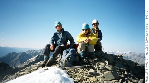
Mt Charles Stewart 166682 Scramble on 27-Aug-2005
Coordinator David, was joined by 3 lovely ladies, Susan, Alda and Christine to leave Shouldice at 7.00am. Between Canmore and Harvey Heights is a network of trails. We were looking for Stoneworks Canyon. Alda asked a woman at a small horse ranch (Johnny’s Stables ?) East of the highway and was told the trail was adjacent to the ranch and we could park our car in their car park GR148627 nad1983. We did, and started up Johnny’s trail at 8.40am. Johnny’s trail parallels Stoneworks creek through the woods and eventually into Stoneworks canyon. There is a trial sign after about 1 km and another sign in about another 1 km, but it is fairly easy to head up creek on the good trail which is generally 50 metres to the north of the creek. The trail follows the creek into Stoneworks canyon and fizzles out in the open talus slopes above. These talus slopes form a huge bowl which leads without any real technical difficulty to the peak of Princess Anne (GR 173670, nad 1983) SC5 to this point. We lunched on Princess Anne at 1.00pm, signed the fairly new ACC register, admired the views and waived at voices on Squaw’s Tit.(Update July 2019: The more common name for this peak is now: "Charles Stewart-South Peak").
Soon after 1.00pm we started along the ridge to Mt Charles Stewart and soon got into difficulties. There were several tricky drops but with a bit of rope work (SC 7 or so) we eventually got down to the ridge proper where we found a huge 2 metre cairn in the col.

South East Ridge on Mt Charles Stewart

Summit Mt Charles Stewart
Because we did not want to go back over Princess Ann or go into any westerly drainage where we still could not see whether or not there were cliffs, we side hilled all the way around the upper bowl and ridge to reach a small col on the ridge connecting Squaw’s Tit to Princess Ann. It took about 1.5 hours and was quite ghastly with every step moving unpredictably. In retrospect, this is the route we should have taken from Princess Ann to Charles Stewart. Namely from Princess Ann, descend down the ridge towards Squaw’s Tit to a convenient notch, sidehill around the top of the bowl to the Princess Ann – Charles Stewart ridge (and big cairn) which is followed with some detours to the west to Charles Stewart peak- estimate SC6).
At 7.00pm we descended the bowl to Stoneworks canyon via scree and talus. Not nice but effective. Then down the canyon and trail to the car just before 10.00pm (minor headlamp use). 13.5 hours round trip. The ranch owners were concerned at our lateness and we thanked them. Since we each had hiking plans for Sunday, we drove back directly after a brief Canmore coffee stop (Wendy’s and Tim Hortons closed at 10.00pm). I got 5 hours sleep before the 5.30am alarm for Sunday’s Mt Bogart. Alda was doing 3 or 4 day trips in a row. How nice to be retired!.
Thanks for the great company from coordinator and scribe David. I will not be repeating this one in a hurry. Also thanks to Alda for suggesting this route which turned out to be effective but not pretty. Allan, we still cannot say for sure if “your” ridge route will go or not. There are slabs but they may be passable, maybe not, we could not see enough. Sorry.