Crowsnest Pass to Waterton (Partial GDT) Off-Trail Hike on 1-Aug-2005
The Canadian Divide Trail from Crowsnest to Waterton is probably the finest ridge hike that I have ever done. At nearly 100km long and about 5500 metres vertical it is also one of the longest and toughest. But with perfect weather for a week, the views were spectacular, the flowers exquisite and the company of John and Christine excellent. A marvellous week's holiday. Details and photos later. Scribe and coordinator, David.
Crowsnest to Waterton Backpack, August 1-7, 2005 Report, Details by David
The objective was to hike the Canadian Divide Trail (CDT) from just South of Blairemore to Cameron Lake via the alternate high level route described in Dustin Lynx’s book. Total distance about 90km and 5500metre elevation gain and loss over 7 days and 6 nights.
David and Christine met John on Monday 1st August 2005 to commence hiking South along Willoughby Ridge from GR810910 about 12 km drive South of Blairemore. David’s and John’s packs weighed 52lbs each and Christine’s 44 lbs. The weather was hot (20c), windy in the afternoon, mosquitoes and horse flies were present, many flowers in abundance, the views amazing. It would remain similarly all week. It was a fantastic trip. We did not see another hiker all week and only a few car campers on Monday and Tuesday. There was negligible wildlife and not one sign at all indicating that this was the CDT. On Monday and Tuesday we mostly followed ATV tracks and the two GPS’s were useful for identifying our exact location. This was a fast learning experience for us all especially with the various units (NAD1927, NAD1983, feet or metric). I wish that the government would produce metric maps worthy of the 21st century. Apart from one minor distance error, Dustin’s book was accurate though difficult to read backwards.
Willoughby Ridge was very pleasant and the feared crossing of the Westcastle River a non-issue (15cms deep, 8 metres wide). The 750 metre ascent to scenic Southfork Lakes on Tuesday afternoon was a grunt. Wednesday and Thursday were the tough days along Barnaby and La Coulotte Ridges. Hiking or scrambling was mostly on a rough trail on a 3 metre wide swath on the crest between BC bush in the West and a 600 metre cliff to Alberta in the East. It was fantastic, though a couple of SC6 sections needed some pack ferrying. Looking North, we later thought that we could have bypassed these sections by a ledge on the BC side. But what the heck, we were Ramblers and this was not a “woosy” Ramblers backpack. Carrying water for the whole day was also necessary. We were exhausted by Thursday evening and the scheduled short (8km) Friday on a horse trail came as welcome relief. This day we circumvented Mts Matkin and Font but due to our tired state did not give their ascent serious consideration. Mt Matkin looked a technical climb but Mt Font about SC5. We doubted that either saw many ascents. Instead we each bathed in the pleasant Font Creek and I even shaved.
Saturday night we camped at South Kootenay Pass on the Waterton Park boundary. But we had a 5km return trip to Grouse Lakes in the Park for water and supper. Saturday night in the wilderness was not exciting as we were all in bed by 9.00pm in anticipation of the 7.00am Sunday departure for a final long day along the Park boundary over Mts Festubert and Rowe to Cameron Lake. Although hard, Sunday proved easier than expected as we followed a rough trail near the cliff edge with only the occasional scramble section. Naturally, we could not find the cut line down to Alkamina Pass and did the obligatory 1 hour Rambler bushwhack before reaching the John’s van and other people.
We enjoyed an excellent buffet supper ($12.95) at the Heritage Inn in Pincher Creek before returning to my untouched car near Blairemore around 9.00pm. We were home in Calgary by midnight. My pack now weighed a comfortable 34 lbs. Thanks to John and his family for making the car shuttle so smooth and to both John and Christine for their great company on a truly memorable backpack. We are still very much talking to each other! In hours, the days were approximately: 7, 10, 12, 11, 5, 7, and 10.5. It was worth every gram of effort. Scribe and coordinator David.
I'll add some photos to David's report. They really do not do justice to the trip - I missed taking pictures of things like the wonderful campsite at Font creek, flowery meadows, lakes panoramic vistas etc. - great trip with great companions! Digital photographer John
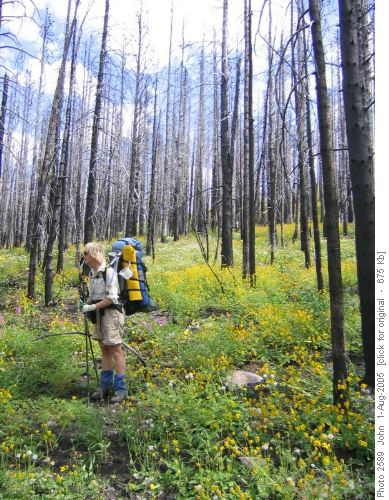
Ascending to Willoughby ridge
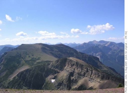
Barnaby ridge
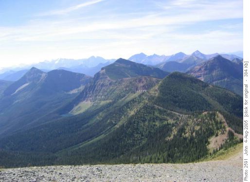
La Coulotte ridge
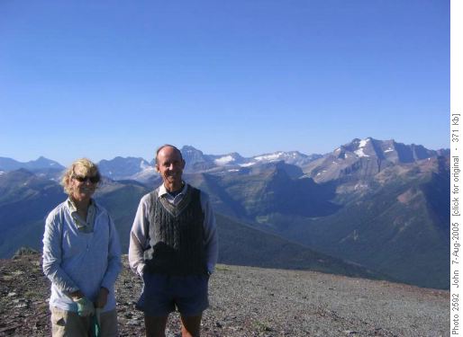
Summit Mt. Festubert
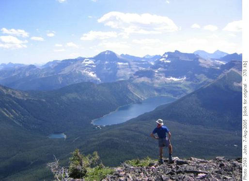
Cameron lake and Akamina pass