Shangri-la (Dunbar Lakes) via Templeton Lake: BP Scramble on 30-Jun-2
Well, imaginary it isn't; remote, it is; and as four rambler adventurers found out on Canada Day weekend, 2006, British Columbia's version of Shangri-la is definitely a backpacker's utopia.
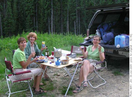
Located in BC's Septet Range, west of the Columbia River Valley, the trailhead itself is difficult to find and requires careful navigation through a maze of logging and forestry roads. And once at the trailhead, there are hazards to overcome before even setting out on the hike. We had gotten off to an early start, leaving Calgary by shortly after noon on Friday, so after recovering from a number of wrong turns onto a number of wrong logging roads we eventually arrived at the trailhead by around 6:00 pm, where (of course) there was no place to camp. We backtracked down the Bugaboo-Templeton Service Road until we found a wide and relatively flat spot on the road where we could set up camp, have dinner and spend the night. The coordinator brought out the table, chairs, and wine; Margaret provided the chili, salad, rolls and dessert (Nanaimo Bars! Yumm!!); we all had our own beer in the cooler; and Joyce & Ginger provided sparkling dinnertime conversation.
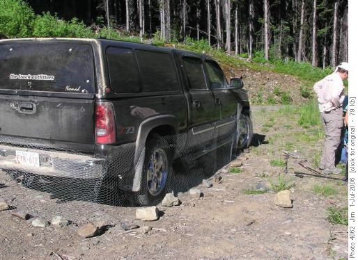
Early next morning, we got up; had breakfast (Yoghurt, fresh fruit & milk out of the cooler); got ourselves organized and headed off the to trailhead, where we had to protect our vehicle from the ravages of . . . voracious porcupines with a taste for brake lines, electrical wiring and even tires. We had been warned by the guidebook to encircle the truck with chicken wire as a pre-emptive strike against porcupine attacks.
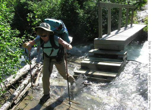
The trail to Templeton Lake is actually quite good and, while not maintained or travelled frequently, is quite easy to follow. There is a bridge to cross;
a beaver dam to circumvent;
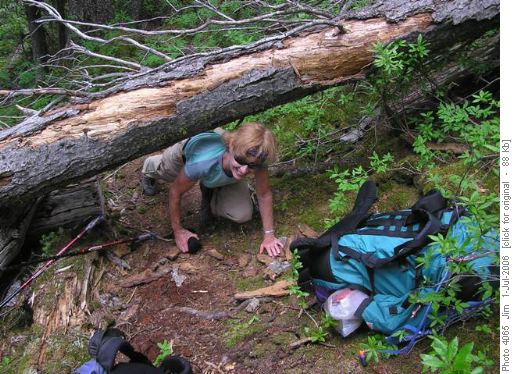
and the odd obstacle to overcome.
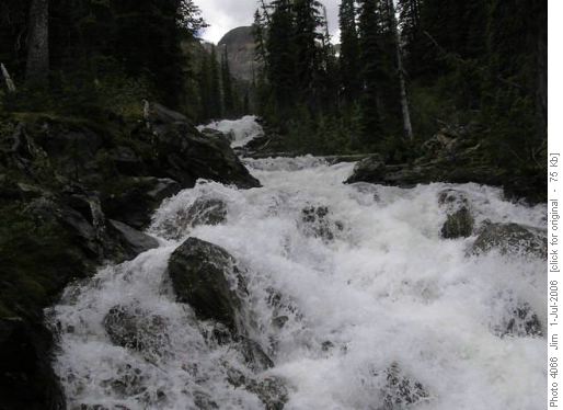
But after a few hours you are making your final steep ascent alongside a tumbling waterfall
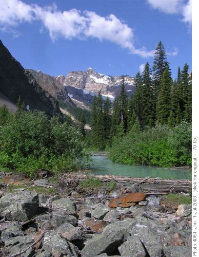
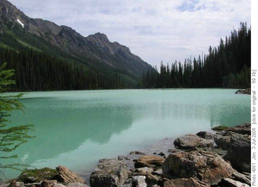
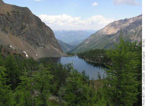
before arriving at Templeton Lake
where we were met by . . . mosquitoes, hoards of blood-sucking mosquitoes.
Now, "I'm mostly tolerant of just about all critters. Unless those critters happen to be meskitters. When those little suckers tap into my juices, my sense of humour quite quickly reduces. Those bloodsucking vampires do indeed raise my wrath. So I'll squish everyone of 'em that crosses my path." Feable attempt at Cowboy Poetry, J. Powers, August 7-8, 1997
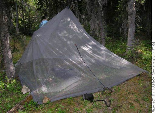
Fortunately the coordinator had planned ahead for such an invasion and brought along a 'Bugamid', a pyramid shaped tent made of bug netting, manufactured by Integral Designs, that provided protection for four Ramblers with sensitive hides. We quickly set up the Bugamid, dove in and enjoyed a quiet lunch and a nap, protected from attack by the ravenous mosquitoes. After lunch we packed up and followed a sketchy trail along the south side of the lake, in search of a creek that would lead us up to the col separating Templeton Lake basin from the Shangri-la (Upper Dunbar Lakes) basin. After crossing a dry creekbed, we continued on for a short ways until we came upon a creek with a significant water flow and an excellent campsite. We noted the campsite location and began to follow the creek up to the first col above Templeton Lake. This was a grunt, especially with heavy packs, and after bushwhacking along the creek and stumbling up rocky slope, we decided to take a break at a large rock and assess our options: A) Continue on this exploratory route to Shangri-la; B) Retreat to the aforementioned campsite for the night before continuing our backpack to Shangri-la the next morning; or, C) Retreat to the aforementioned campsite where we would establish camp for two nights, and day hike with lighter packs to Shangri-la in the morning. Consensus was quickly reached (Four, yea; Zero, nay), Option C was chosen and we retreated to the aforementioned campsite at Templeton Lake where tents were set up; the 'Bugamid' erected
and dinner was on the go.
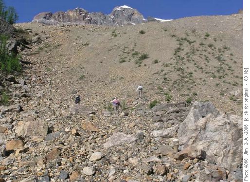
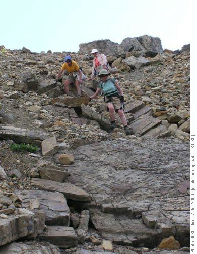
Next morning off to an early 7:45 am start, with considerably lighter packs, we were soon at our large rock, now referred to as 'Decision Rock', where we assessed the route before us. We quickly realized that the worst was yet to come, a steep slope of hardpan with little or no traction, soon to be named the 'Bitch Pitch' by the ladies.
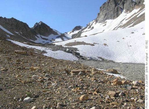
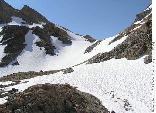
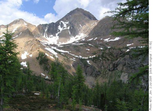
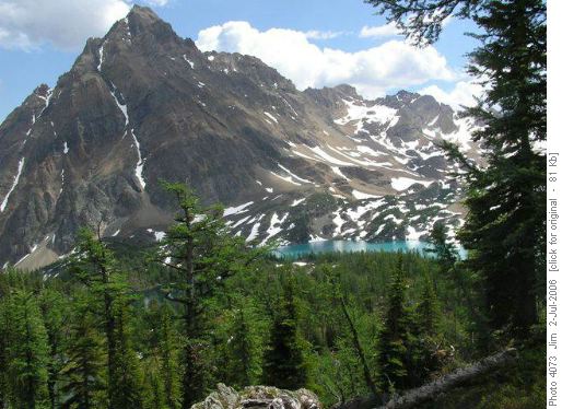
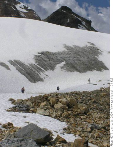
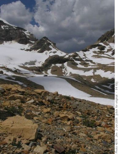
Fortunately, the 'BP' did prove to the worst obstacle that we would be faced with and it was nice to get it out of the way early. Continuing on we ascended over a moderately sloped glacial moraine, past a moraine lake, over sporadic snowfields,
up an easy (SC5) section of good, solid rock;, finishing with an easy climb up a larger snowfield .
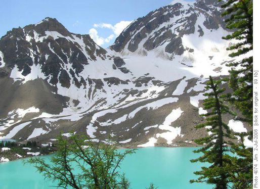
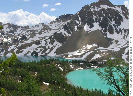
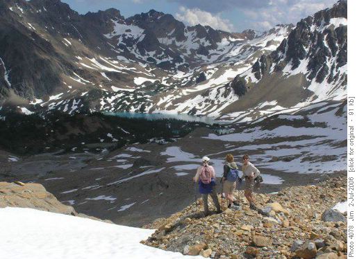
From the col the vistas open up and you are presented with a stunning view of the Shangri-la basin below you. An easy descent over snow and scree takes you down into the basin and a short ascent takes you to a viewpoint with the lakes (Upper Dunbar) of Shangri-la arrayed beneath you, overshadowed by Mount Ethelbert and Horeb Mountain.
. After our brief exploration of Shangri-la, we began out ascent
back to the col
and after a last lingering look at Shangri-la
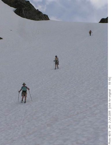
we began our descent to Templeton Lake. Excellent boot-skiing
down the snowfields made quick work of the descent and soon we were back at the 'Bitch Pitch' where the coordinator was able to find a manageable SC5 descent
through rock, thereby avoiding the treacherous hardpan.
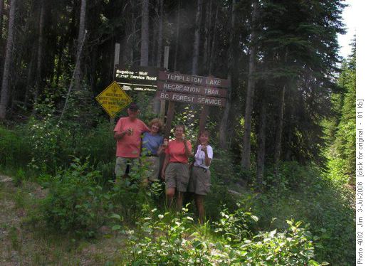
One more night at Templeton Lake campsite, enjoying the protection of the 'Bugamid' and it would be an easy hike out to the trailhead. Next morning, our last at Templeton Lake, we awoke early to gentle sounds of falling rain. No problem, we were in no rush to leave so we all rolled over in our sleeping bags and caught another forty winks until the rain had abated. Breakfast in our bellies and camp packed away, we were on the trail by 11:00 am and back to the trailhead by 3:00 pm. The only problem we encountered during our return was that we missed the beaver dam where we had to cross to the north side of the creek and continued across a talus slope for maybe half a kilometre before the coordinator noticed his error and we were forced to retrace our path. Back at the trailhead, cold beers were opened and inhaled, the chicken wire was removed from around the truck and stored away, and a final group photo was taken at the trailhead sign.
An hour and a half later we were soaking away any stiffness in the hot springs pool at Radium before adjourning to Backcountry Jacks, Radium's finest steakhouse, for an incredibly fine celebratory meal. On the road by shortly after 8:00 pm; we were back in Calgary 10:45 pm, thanks to exceptionally fast moving, late evening traffic.
This trip was exceptional, to what I consider to be the finest destination I have ever visited in the Canadian Rockies, accompanied by one of the best groups I have ever had the pleasure to hike with. The scenery and the route was breath-taking but it was the group that made the trip so memorable. My thanks go out to my fantastic travel companions, Joyce; Ginger and Margaret. They were a delight to spend a weekend with and I look forward to many more future opportunities to backpack with them.
Trip statistics: Distance - 24.8 km; Elevation gain - 1647 m; Maximum elevation - 2561 m; Trail time - 21 hours, 39 minutes
Coordinator, photographer & scribe: Jim.
If you go where most folks don't go; you'll see things that most folks don't see.
