The connecting ridge between Wasootch Peak and Kananaskis Peak turned out to be an absolute delight! Our party of 3 started out at 8 am with perfect hiking temperature, but with a slightly smoky haze. The well-trodden trail brought us quickly & steadily up to treeline where the sun warmly greeted us.
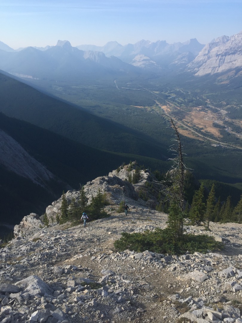
Ascending Wasootch Peak
We arrived at Wasootch Peak in a couple of hours.
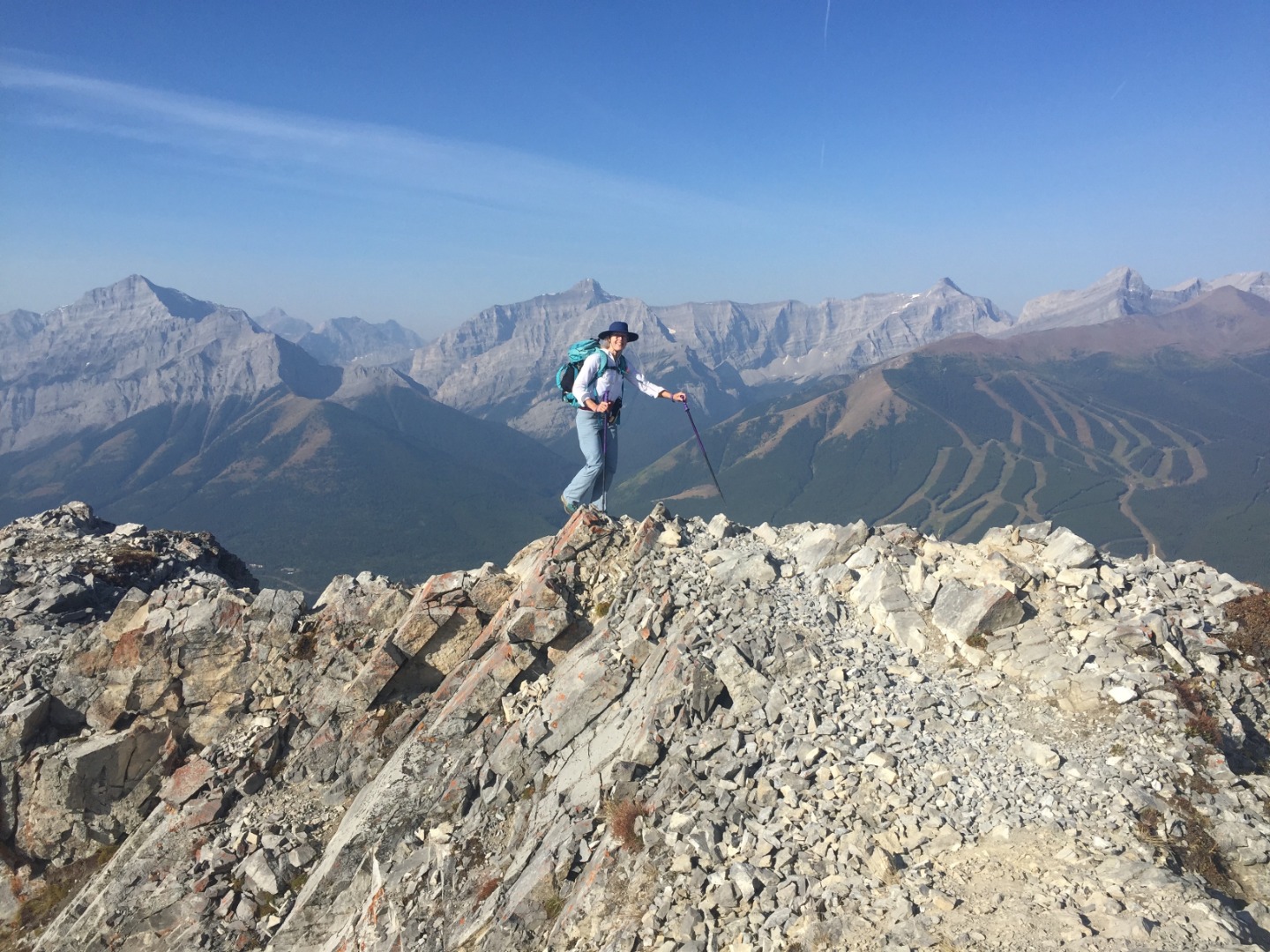
Carolyn arriving at the summit of Wasootch Peak
Today's forecast was for wind gusts in excess of 45 kph and we started to feel the wind as we descended Wasootch heading down to the col. This concerned us, knowing we would soon be on narrow ridge sections. Yet, surprisingly, those promised gusts soon dissipated and we gratefully had calm weather for the rest of the day.
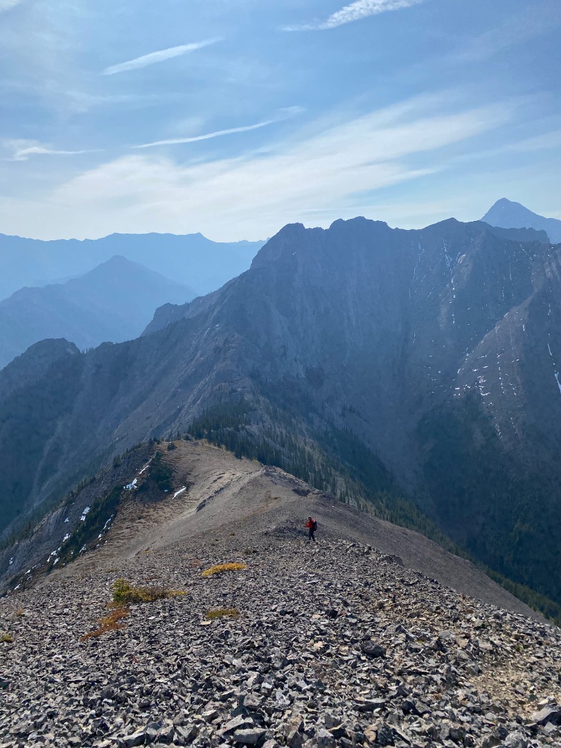
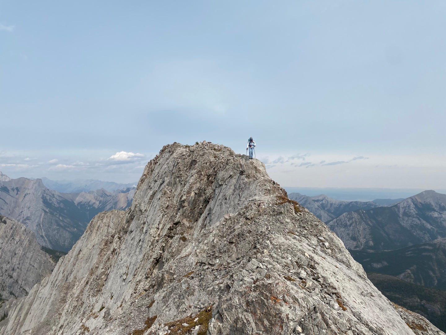
Overview of ridge between Wasootch and Kananaskis peaks (photo courtesy Simon)
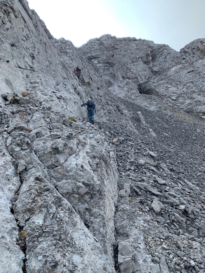
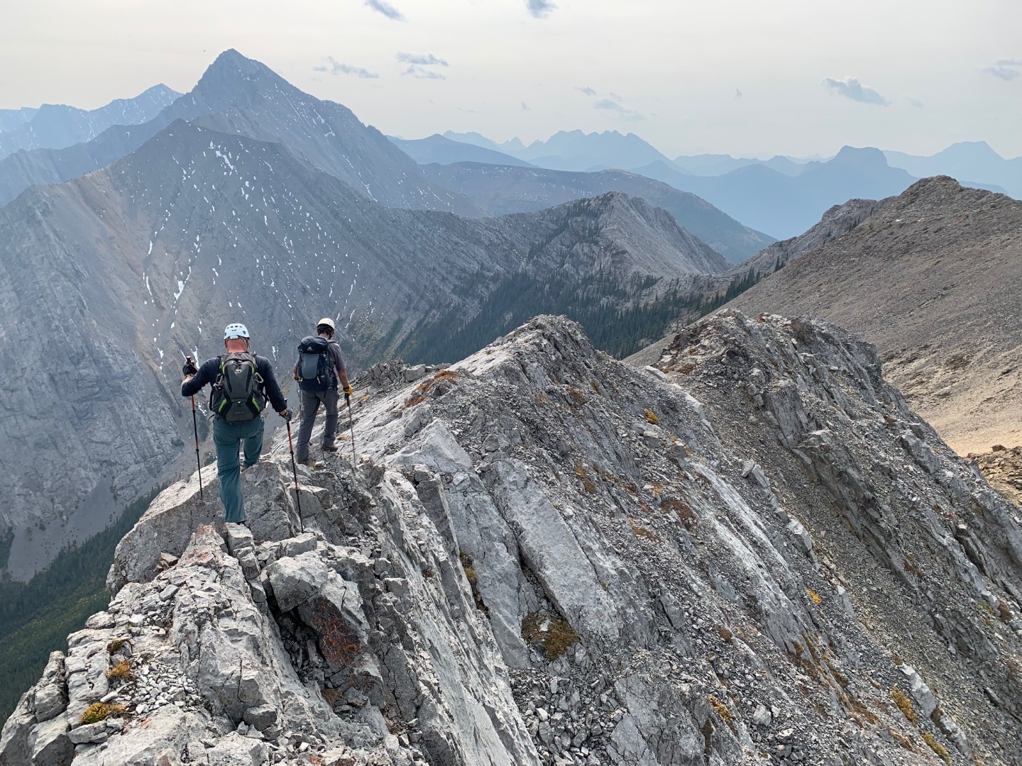
From the col we quickly reached the crux with its infamous steep & downsloping loose rock. Brian went first to check it out. The upper crux section is the most problematic due to all the loose rock, which funnels down on anybody below. Fortunately, Simon and Carolyn safely protected themselves and came up the crux together.
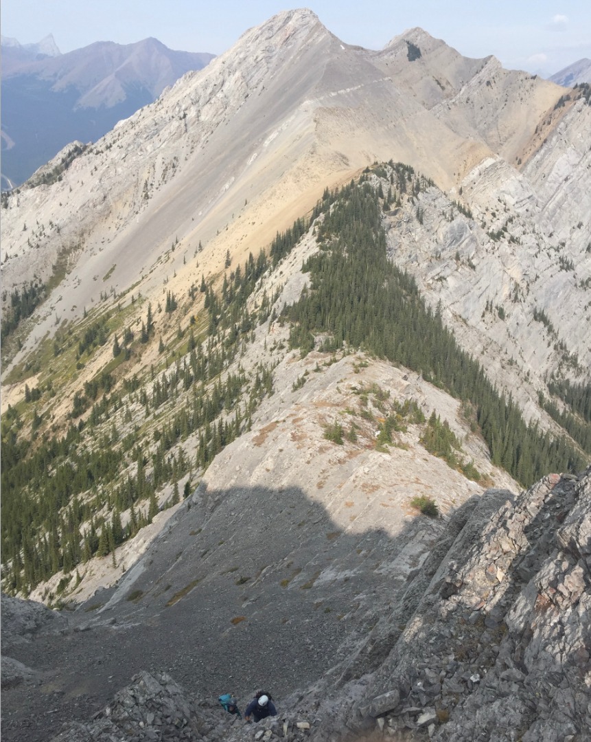
Starting up the crux; connecting ridge from Wasootch Peak
Scrambler's view of the crux (photo courtesy Carolyn)
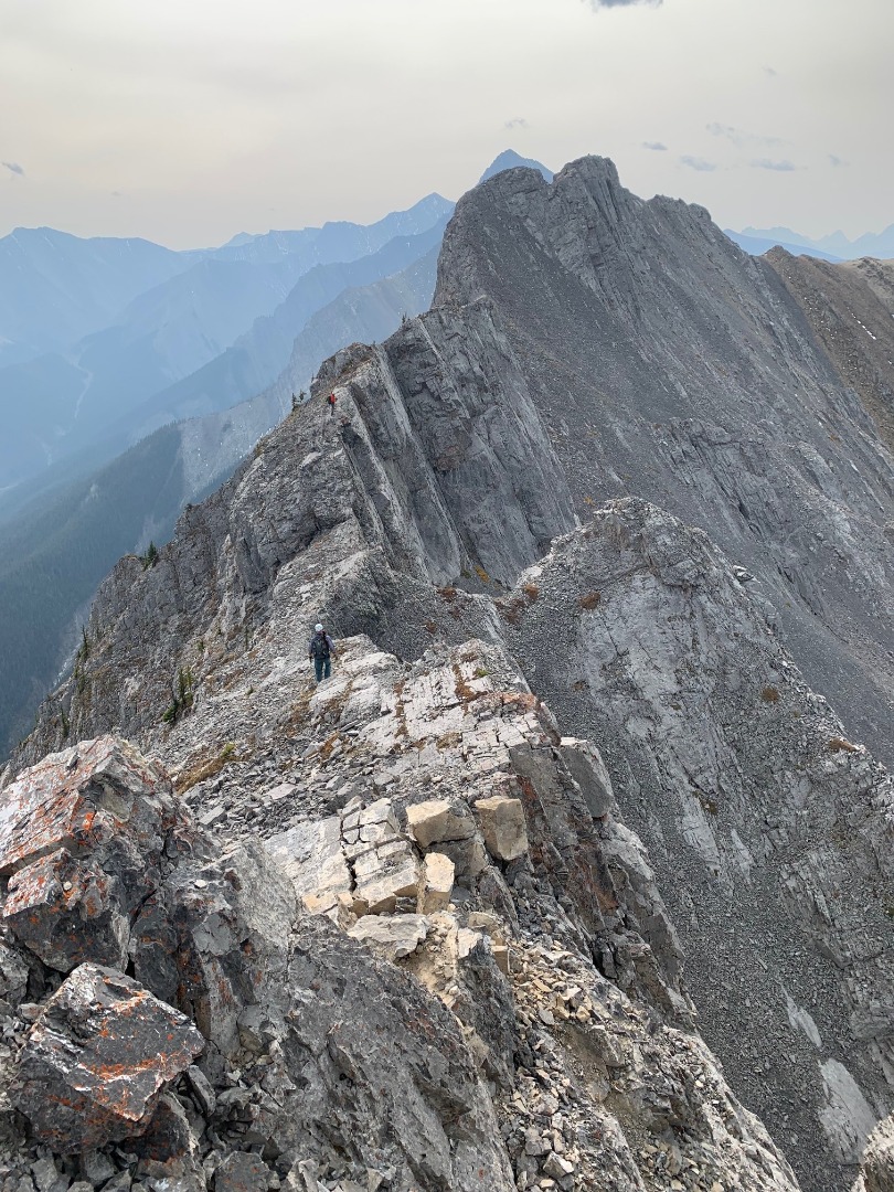
This ridge has plenty of fun surprises in store, making the scrambling both interesting and exhilarating.
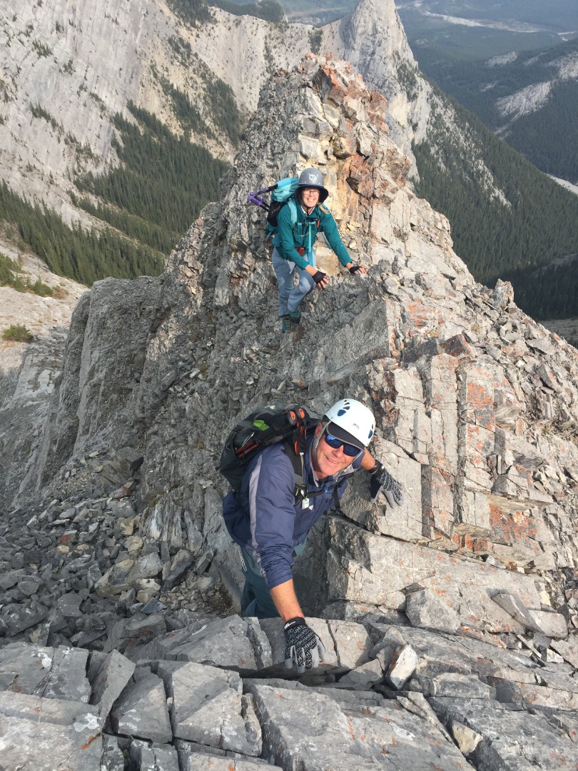
Carolyn and Simon scrambling along Kananaskis Peak's north ridge
Steep cliffs on the west side helped us stay lazer focused on the narrow ledges.
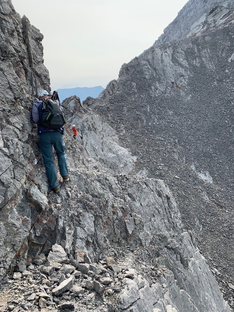
Simon negotiating a narrow exposed ledge {photo courtesy Carolyn)
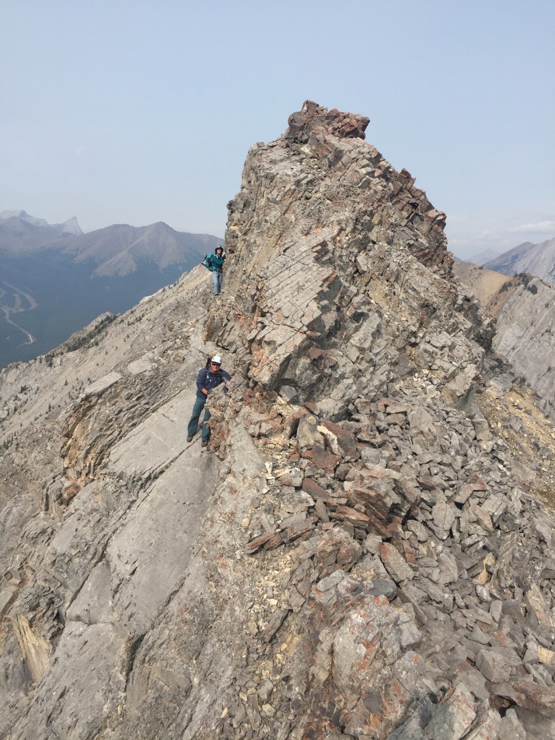
Looking back at the narrow section
We met challenges as we encountered them, one at a time (kinda' like life), feeling grateful to have Kananaskis in our own backyard.
Carolyn enjoying exhilarating scrambling (photo courtesy Simon)
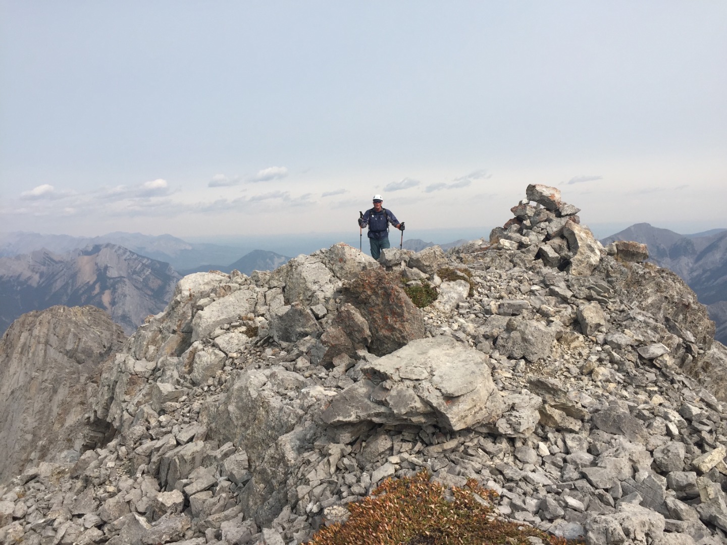
Almost at the true summit (photo courtesy Carolyn)
Despite what the topo map and GPS say, we knew we were at the true summit when we found the summit register inside the summit cairn.
Congratulations to Simon for reaching his 60th unique summit since May, 2020!
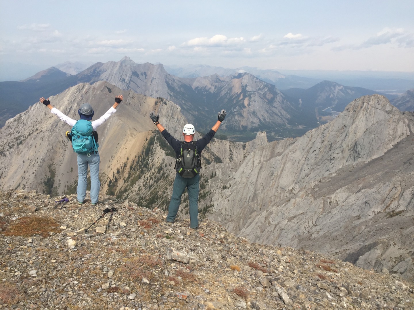
4 hours at a steady pace brought us to Kananaskis Peak where we relaxed and took our lunch break at noon with no wind.
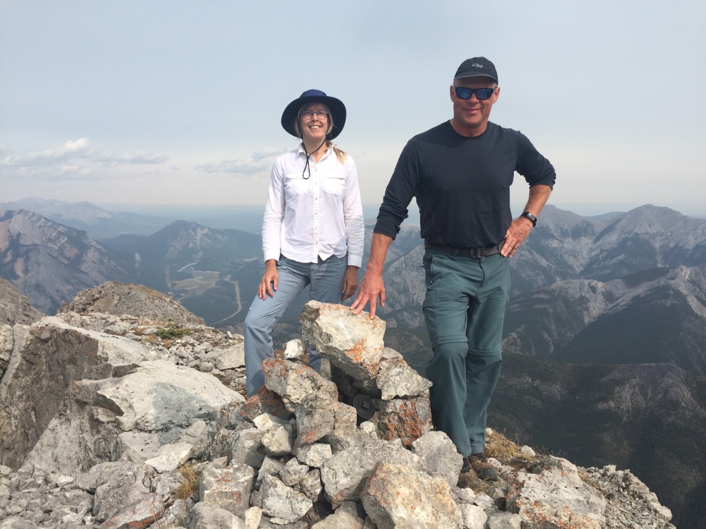
Carolyn and Simon on the summit of Kananaskis Peak
To the SW was what looked to be a slightly lower peak that our maps and devices all report as being the official peak, which had us stumped. So, we decided to go over there to make sure.
Descending to the SW with Old Baldy behind (photo courtesy Carolyn)
According to my GPS, this brown shale summit to the SW is indeed 4 m lower and has no cairn. Rumour has it that the latest trend is for young people to face away with hands raised when getting their picture taken as they bag a peak. Making sure there were no rescue helicopters nearby (didn't want to confuse them into thinking we needed their help with a "Y" signal), we tried it out, just for fun.
Youthful pose on the lower summit; our connecting ridge behind
We then returned to the col for a brown scree descent into the drainage.
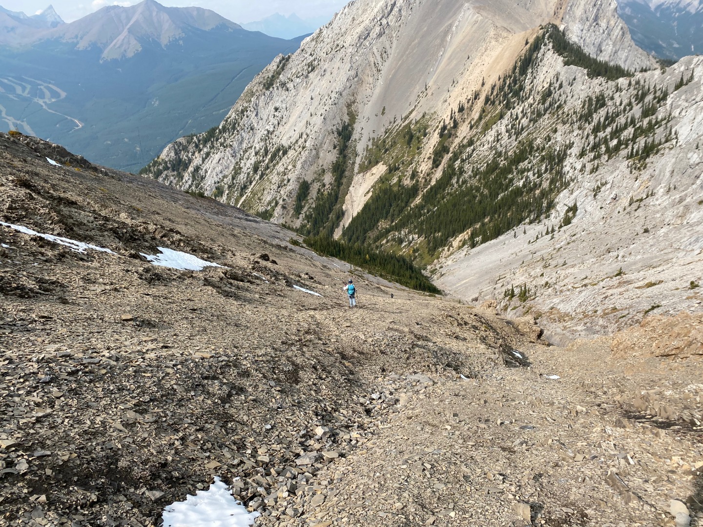
Quick gully descent (photo courtesy Simon)
The scree wasn't great, but we were still able to lose elevation quite quickly. Pessimistically expecting the drainage to be full of debris, we were pleased to find that it wasn't too bad as we rock-hopped our way down either side of a happy little brook. Lower down, we found remnants of trail and a lovely waterfall you can walk behind.
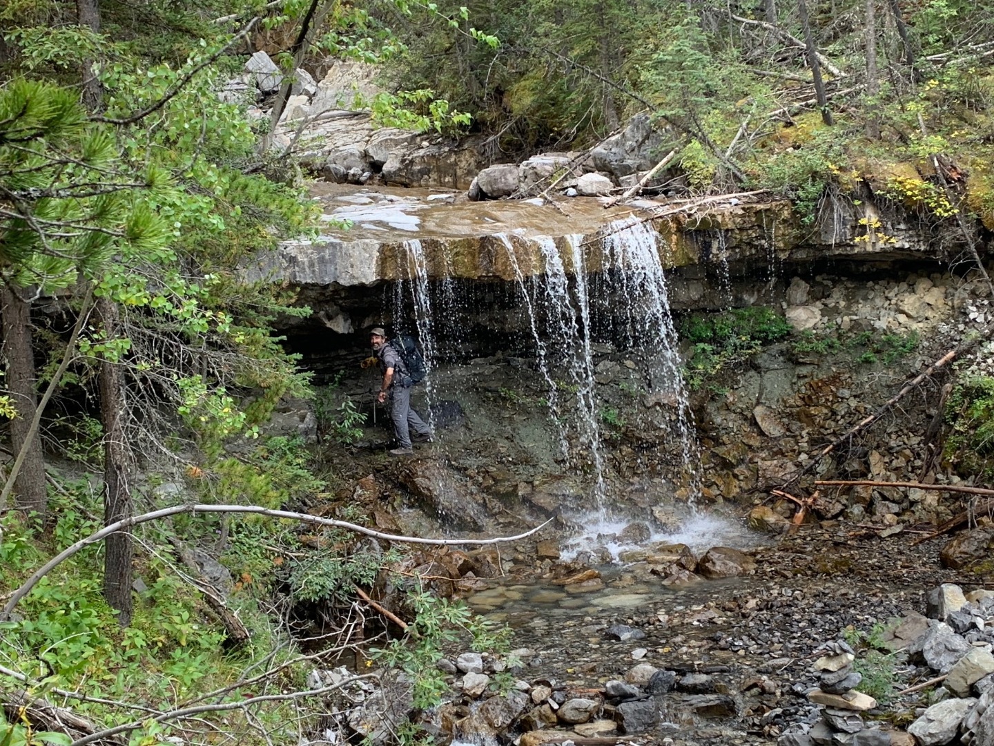
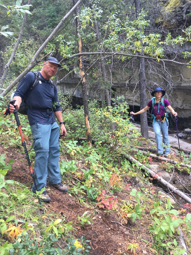
Brian behind a delightfully cool waterfall (photo courtesy Carolyn)
The lower portion of the drainage
We rejoined our approach trail after traversing through a break in a cliffband and were back at our cars in 7 hours. Our route was 10 km with 1,230 total elevation gain.
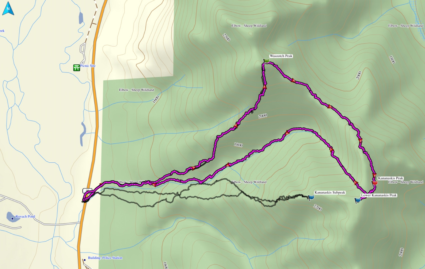
Our route from Wasootch to Kananaskis peak
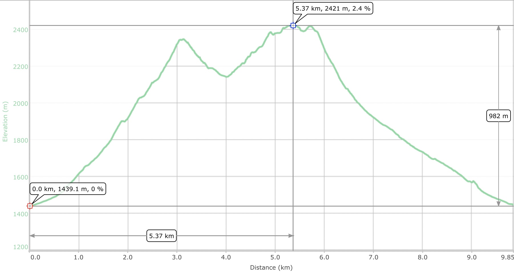
Elevation profile
This trip is well suited to a small number of scramblers who move at a consistent pace. Today's participants made it work well: Carolyn,Simon. Thanks!
Coordinator, Brian