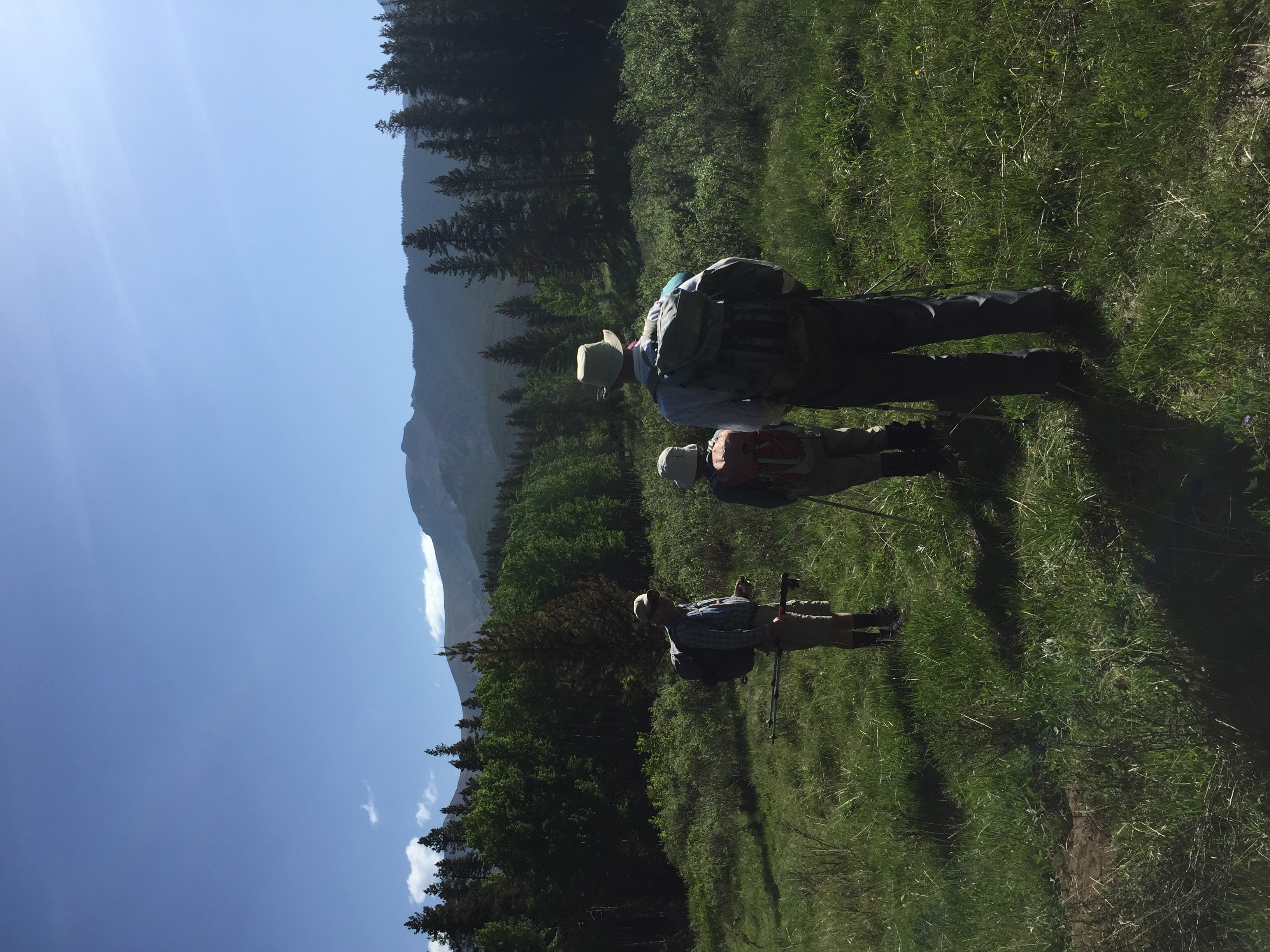
4 Ramblers and 1 guest scrambled the north Burke to Mount Burke loop on June 8, 2018. We parked near the Cataract Creek campground entrance to begin our journey. We first walked north through the campground, then NE across a meadow until we reached a dry creekbed.
In the meadow north of campground, looking at North Burke
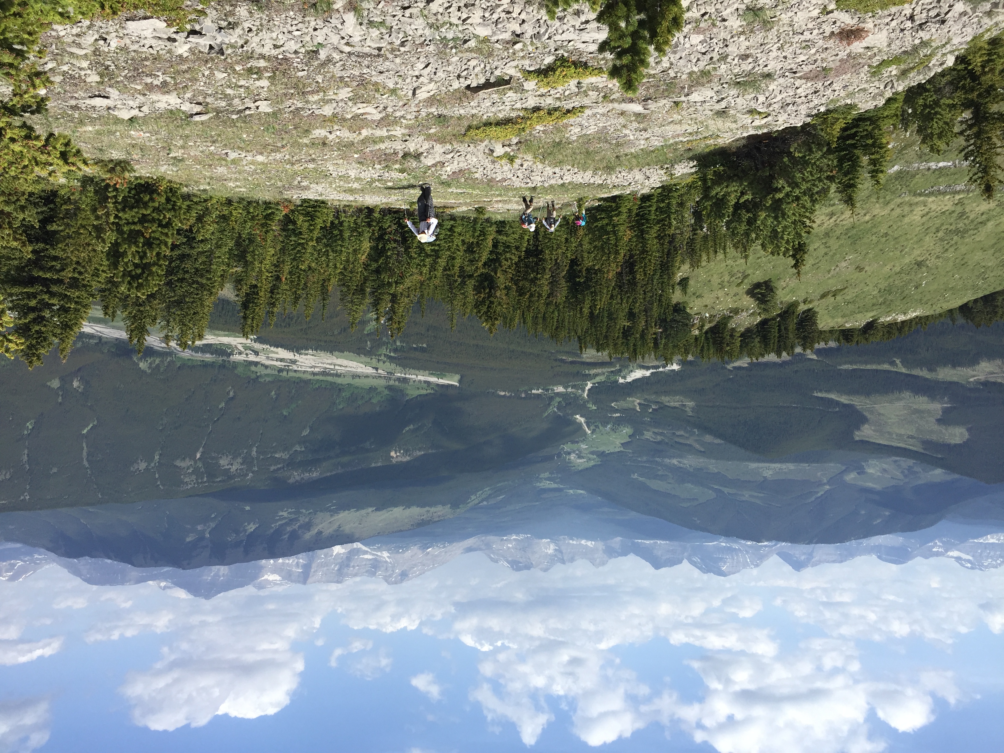
We boulder-hopped eastward, following this drainage until it turned SE, which is when we took to the forest and started our slow but steady ascent through matchstick Lodgepole pines, attempting to avoid as much deadfall as possible. 2 hours later we finally reached the open west ridge of North Burke and stopped for a brief lunch break.
Heading up the west ridge of North Burke
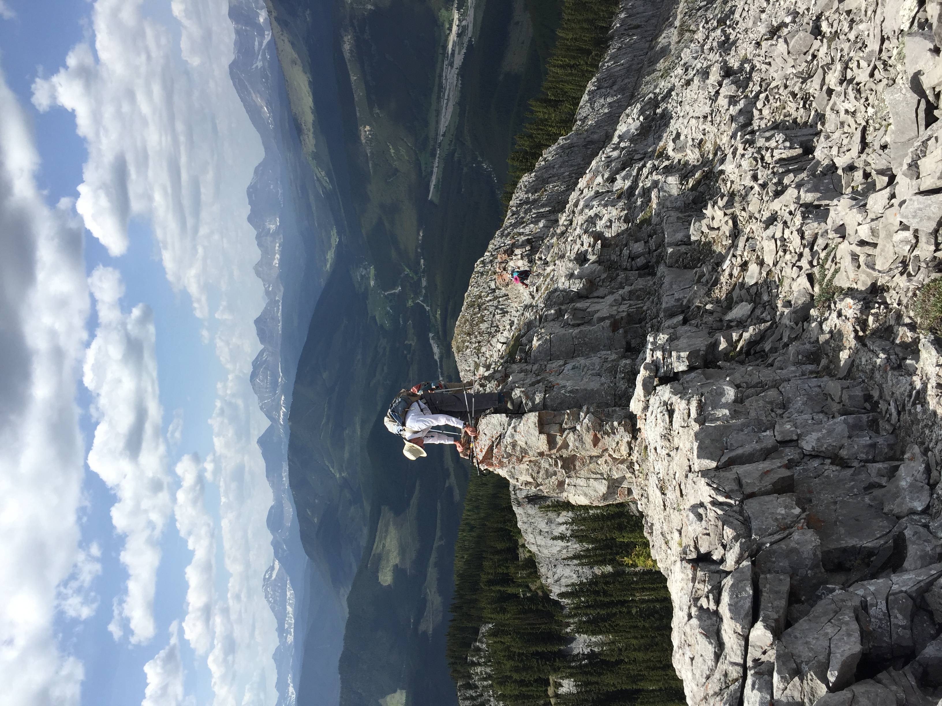
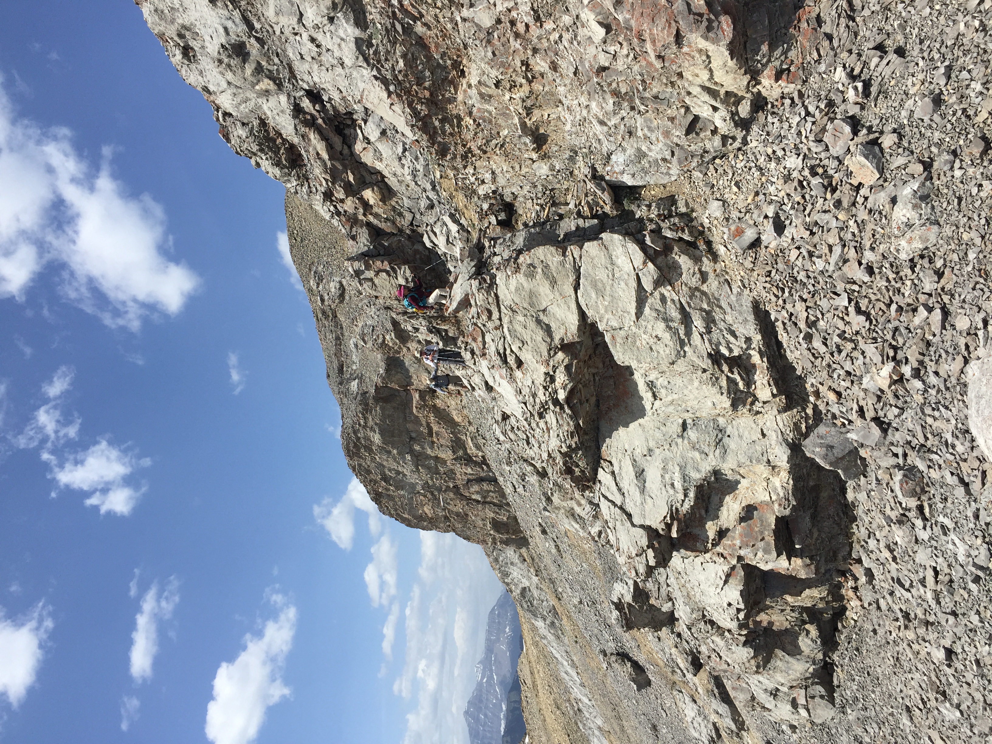
Shortly after resuming our NE climb to the summit, we encountered an imposing near-vertical rocky section along the ridge, which Carolyn & Marianne tackled head on, while David and Harold skirted around to the south, and Brian went around and up on the north side.
David on rocky west ridge of North Burke
We soon found ourselves at the summit enjoying views in all directions.
North Burke Summit
After a short break, we followed the ridge in a southerly direction towards the main summit of Mount Burke, downclimbing intermittent steep sections. The temperature was ideal, with a sun/cloud mix and light SW breeze, with occasional strong gusts (one of which blew Harold's ball cap right off his head towards Longview).
Descending North Burke along the ridge south towards Mount Burke
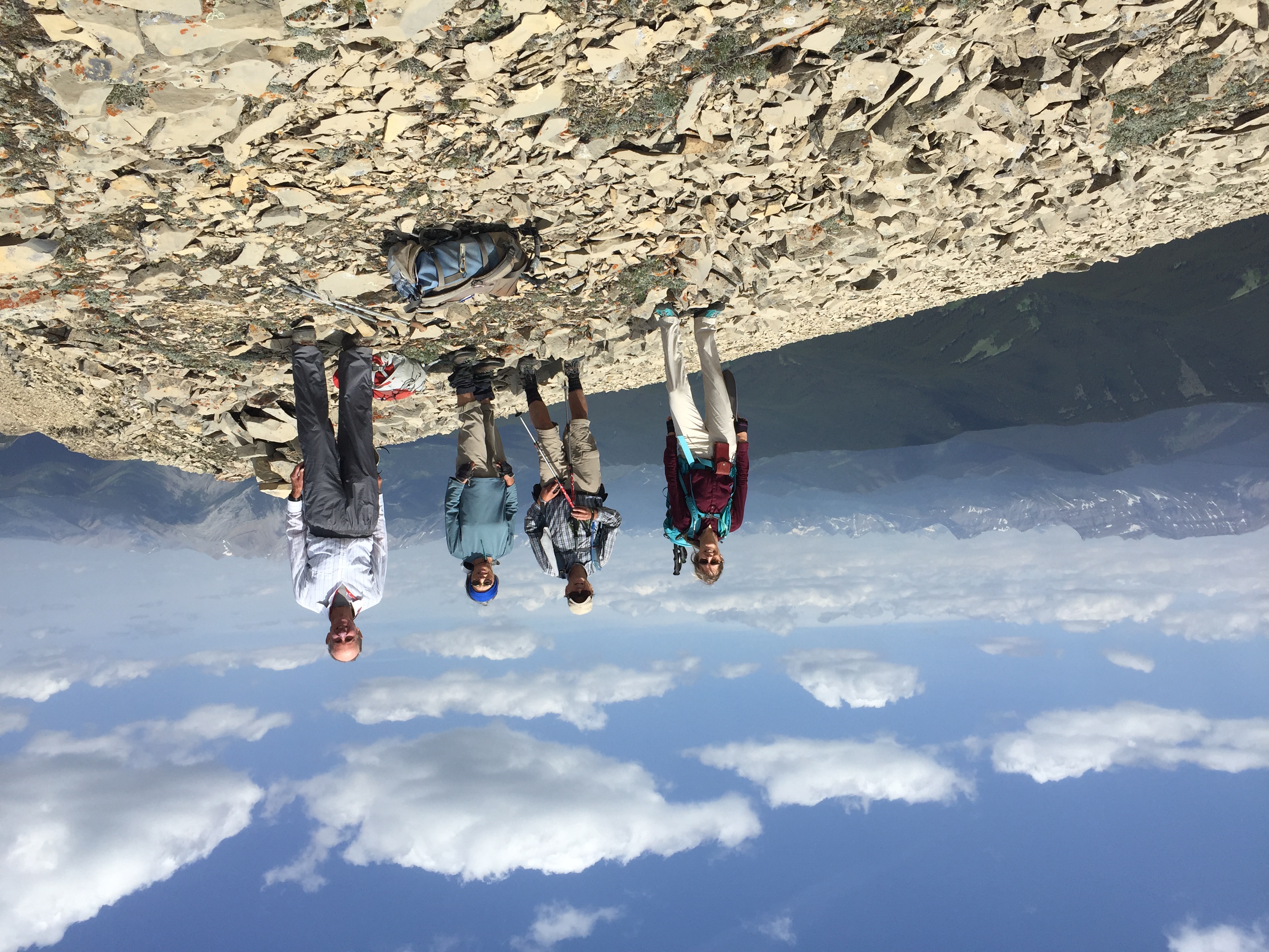
The low point along this ridge was 90 m below North Burke. We all enjoyed good hands on scrambling through 2 cliffbands to gain the summit of Mount Burke about an hour after leaving North Burke.
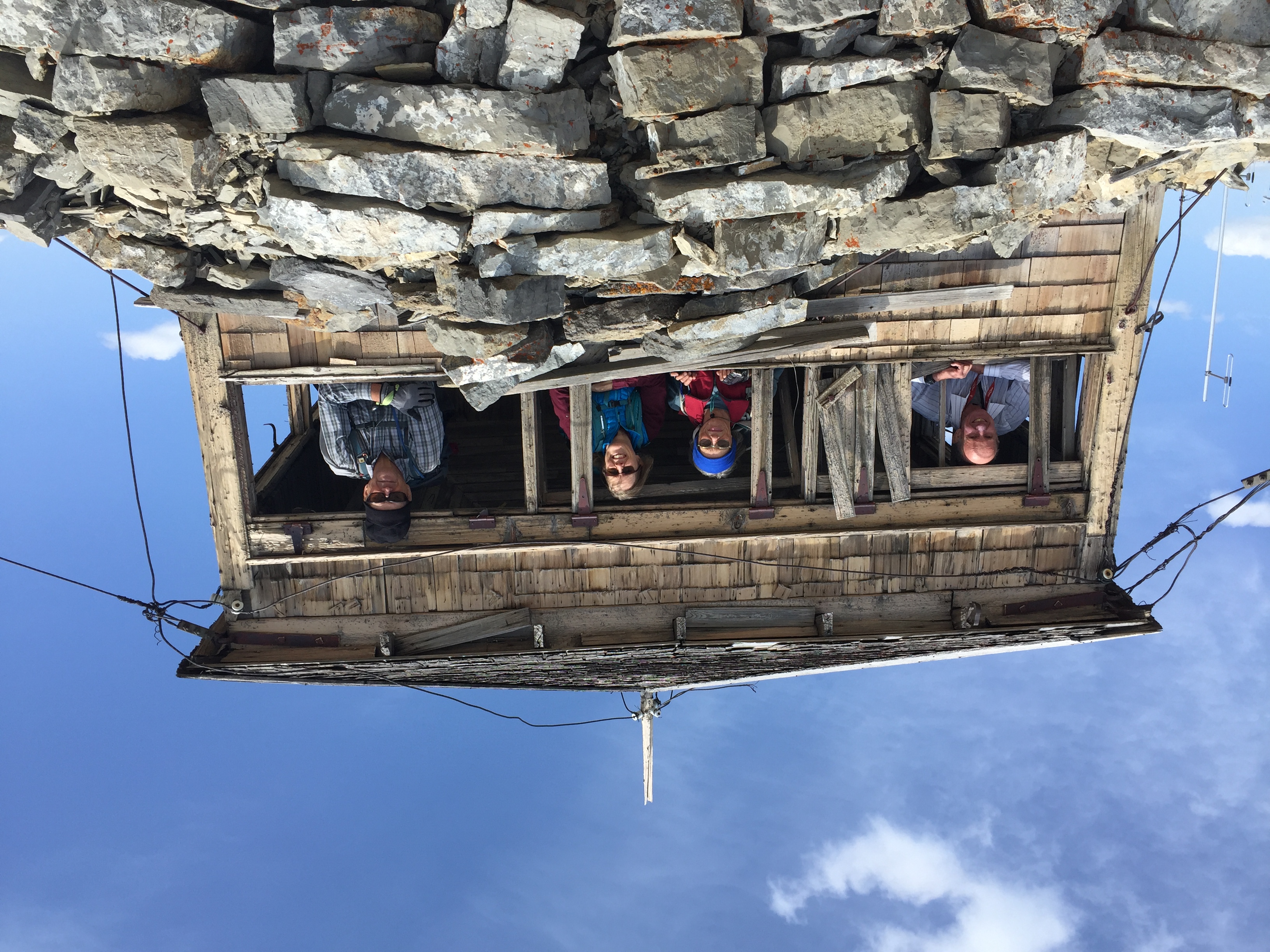
Squatters on Burke: Harold,Carolyn, Marianne Azizi,David
The general consensus was that it is preferable to do this trip clockwise, as we had done, due to the tricky route finding through the cliffband immediately north of the true summit. After checking out the views in all directions from the dilapidated lookout atop Burke, we started our descent SW, that eventually dropped us down into Salter Creek and the grassy meadow leading NW back to the car that we had left 7 hours 45 minutes earlier in the day. Our route was 13.2 km long wih 1,041 m total elevation. My thanks for the great company who joined me on this adventure.
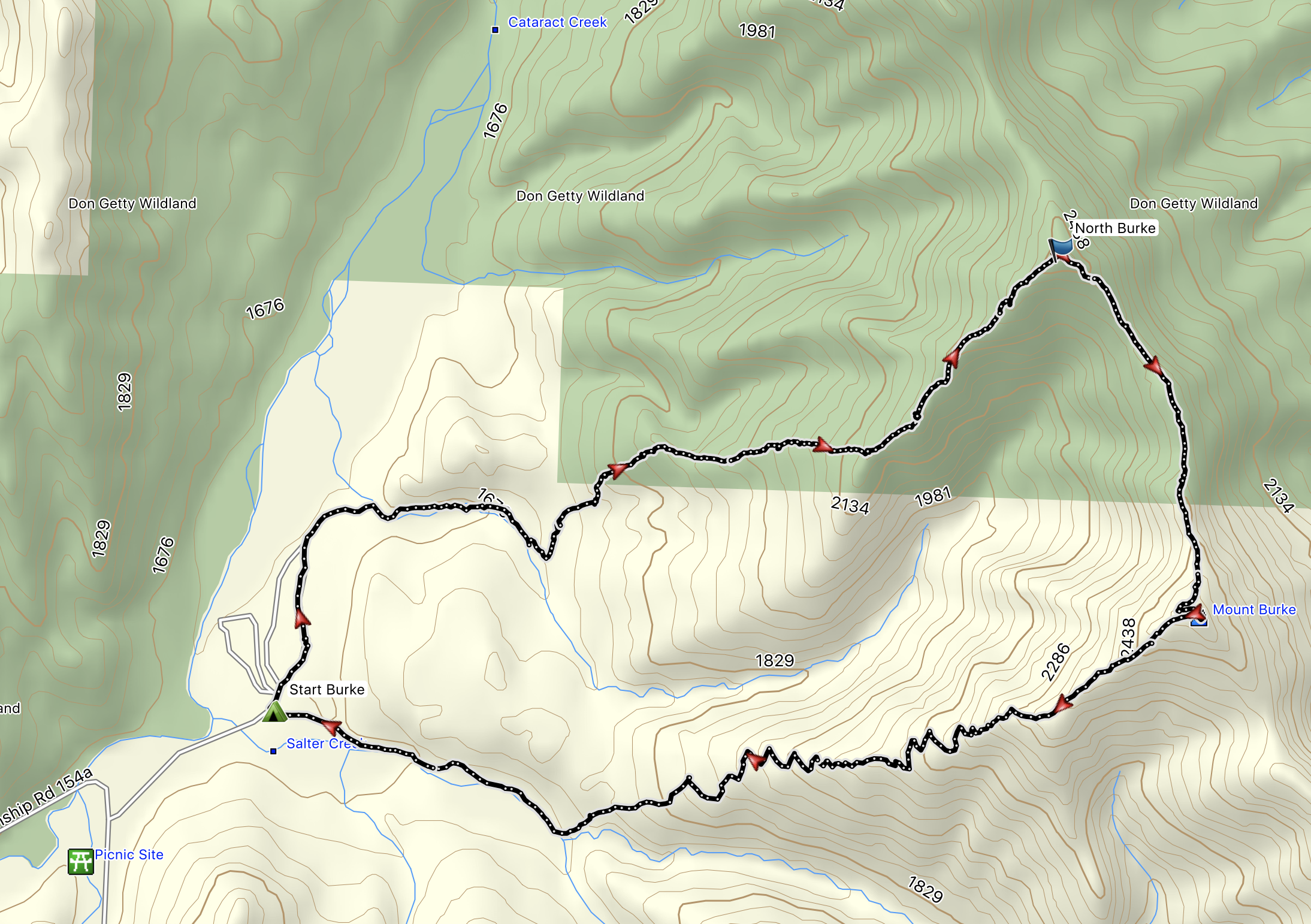
North Burke to Mount Burke route
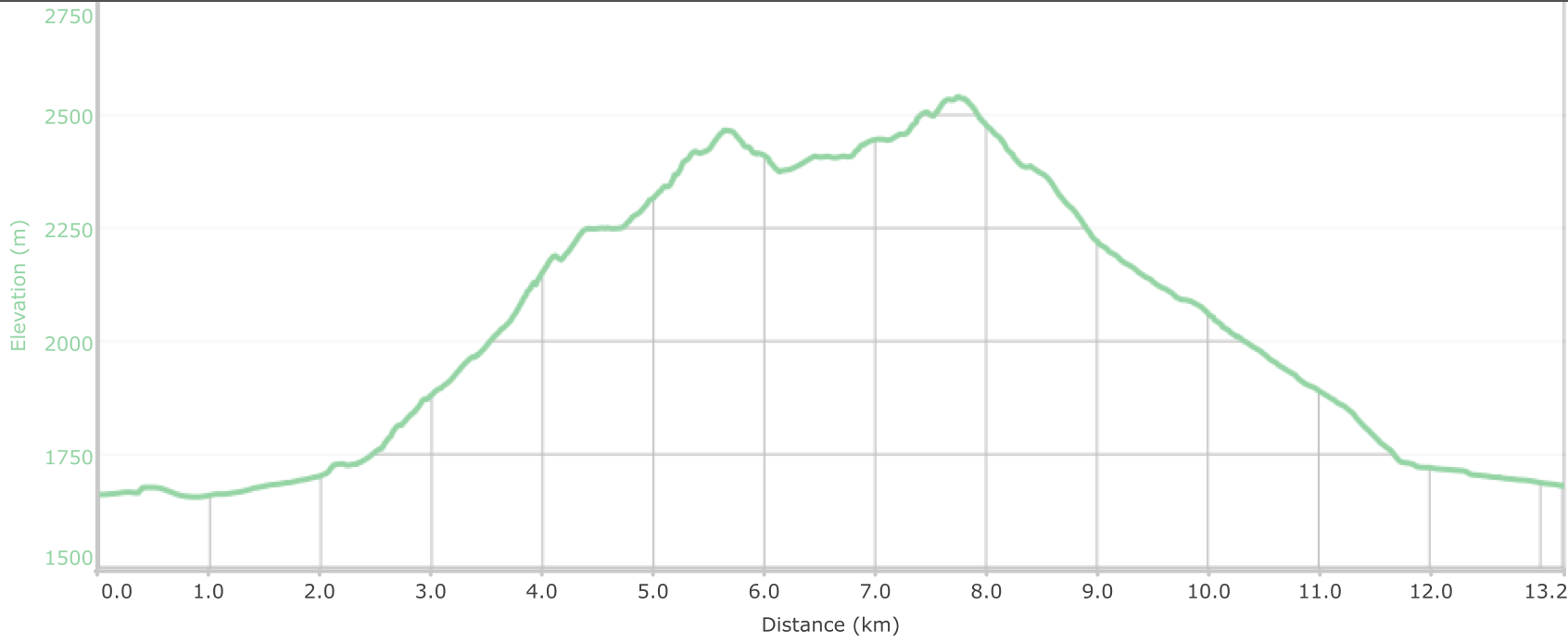
North Burke to Mount Burke Elevation Plot
Participants: David,Harold,Carolyn, Marianne Azizi (guest), and Brian, Coordinator and Scribe.
PS - in hindsight, I'd consider a different approach route next time, perhaps heading east right from the parking area, through the cutblock, buswhacking 100 m down to the creekbed, which could be followed east a short distance until a suitable opening on the north bank would afford earlier access to the more open ridge crest leading to North Burke, thus avoiding a 2 hour thrash through a maze of lodgepoles.