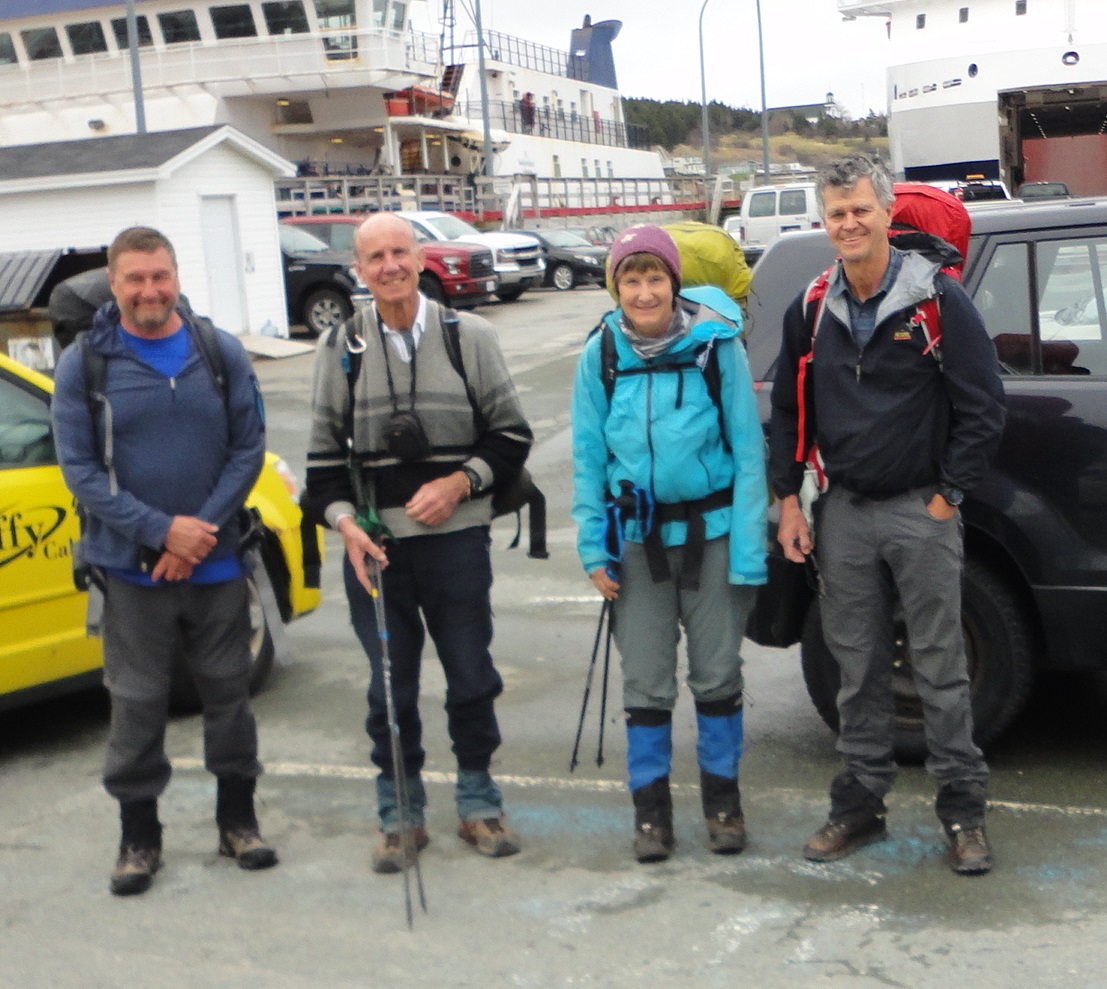
The condensed summary is that 4 ramblers enjoyed backpacking 162km of Canada's East Coast Trail in Eastern Newfoundland from Portugal Cove (north) via Cape Francis and south through St John's to Bay Bulls (km 162) on 20 May 2018. We enjoyed good sunny weather with some wind but cool (+2c) night-time temperatures but negligible rain during this period. The coastal views were great and after the first 2 strenuous days, the hiking was on a good established trail and not too muddy. Except at the long weekend May 18-20, we did not see any other backpackers. Since we accepted rides on some of the roads through the coastal communities, the actual hiked distance was less than 162 km.
KM 0.0 ECT Start @ Portugal Cove North Bill, David, Barbara, Evan
On 20 May, Evan and Bill returned to Calgary more or less as planned. Barbara and David continued as a private trip in worse weather before Barbara left the trail on 25 May 2018 at Ferryland (km 249) to return to Calgary. David completed the trail at Cappahayden (km 312) on 28 May and returned to St. John's just before a fierce storm hit that city on the evening of 29 May 2018. He eventually returned to Calgary very early on 02 June 2018.
Detailed Report:
The 312 km long (8,722 m gain) East Coast Trail (ECT) in Newfoundland has existed since at least 2002 as a series of about 25 day hikes. In recent years it has been growing in popularity as a continuous backpack. When I announced it as a Rambler trip, I was pleasantly surprised to find interest from 3 members for at least half of the backpack (this was 3 more members than expected).
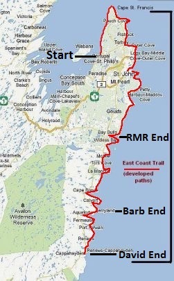
East Coast Trail in Newfoundland, Canada
I drew up a schedule over 17 days giving an average of 18.4 km/day and 513 m/day elevation gain and loss. We picked the dates from 10-31 May 2018, booked airfares and hotel accommodation in St. John’s.
The actual Rambler trip was from 11-20 May (162 km). The schedule worked out well as did the hotel (HomePortHotel.com). We were very lucky with the weather but really should have been a month later. It only rained for 2 night hours during the Rambler trip and was mostly sunny but cool especially at night when it dropped to +2c from usual daytime highs about +10c. The strong wind was a cold deterrent and we soon learnt to camp in the most sheltered spot available. Although we lost it a few times, the trail was well signed and apart from the first 2 days (Portugal Cove to Cape St. Francis) in good condition. The 1:25,000 maps were very good and adequate though some digital information would have been useful. Newfoundlanders were very friendly and frequently helped us even before we asked. We had a good time.
We arrived on different flights but convened in the St. John’s hotel and later at a local pub on 10 May to depart by $50 taxi to the trailhead at Portugal Cove North on 11 May 2018. This hotel had the advantage of having suites with a full kitchen. A large Sobeys and liquor store was next door as was Tim Horton’s. It was about 3km from downtown on the #3 bus route and the hotel provided free airport shuttle service. We had each brought our own tents, stove and food for most if not all the trip. Bruce at Halleran’s Taxi 709-685-2075 was very helpful in shuttling up and down the east coast on highway 10.
As noted above, the first 2 days (maps N6, N7) from Portugal Cove north to Cape St. Francis were a significant notch harder than the rest. The ECT rated them strenuous and not approved ECT grade. Indeed, they were strenuous with steep rocky ascents and descents on a very rough trail. It was with considerable relief that we arrived safely at Cape St. Francis (km 32). The second day took most of us 11 hours for 17.5 km. Fortunately the other days were much better and I really cannot recommend these first 2 days. Evan proved to be a much stronger hiker than the rest of us but we soon worked out an agreeable arrangement (in general Evan went ahead but stopped at regular intervals). He was very helpful in finding campsites and at a few confusing trail junctions. Also Evan had the lightest pack.
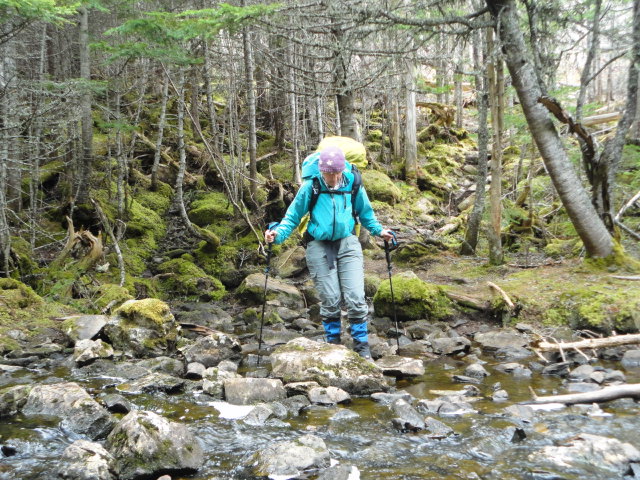
Barbara crosses stream near Bauline on ECT km 13
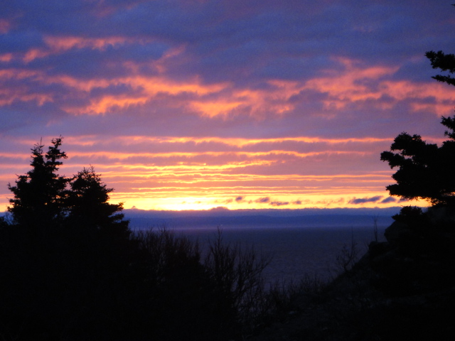
Sunset at Bauline ECT km 13.5
Bauline on ECT km13.5
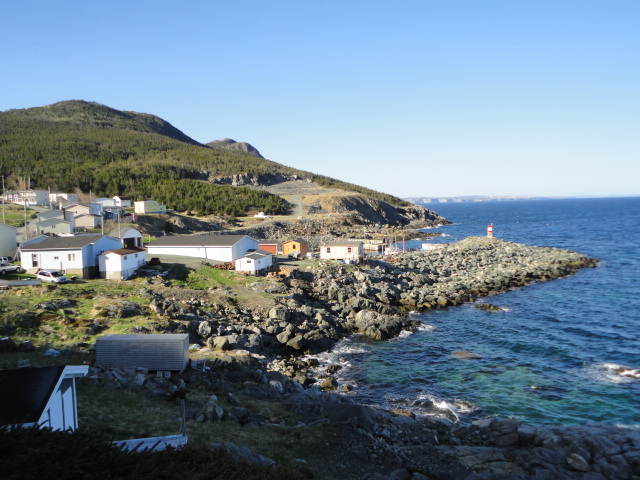
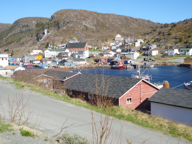
ECT: Typical Cove near Cape St. Francis km 40
The hiking south from Cape St. Francis to St. John’s was probably the best part of the trip.
ECT: Near Stiles Cove Km 52: Evan, Barbara, Bill
Bill on the ECT near Torbay km 68
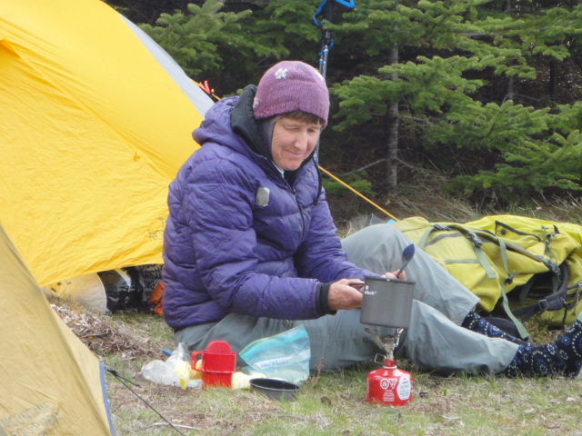
ECT: Barbara cooks supper at North Pomd River km 69.3
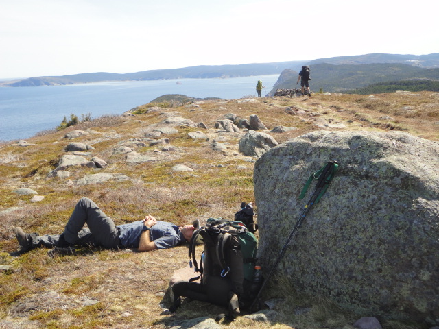
ECT: Evan sunbathes near Sugarloaf km 84
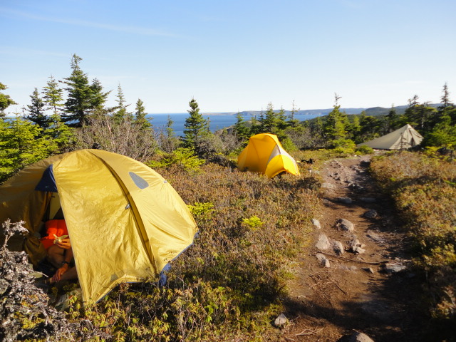
ECT km 87: Camping at Sugarloaf #2
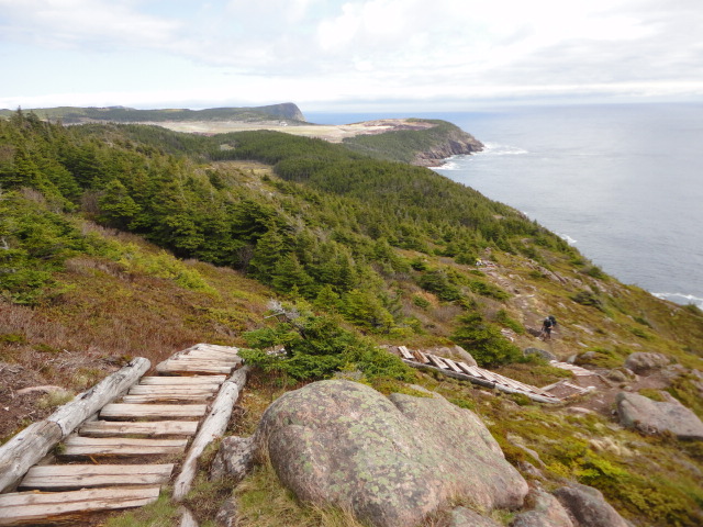
ECT km 90: Steps at Bawdens Highland
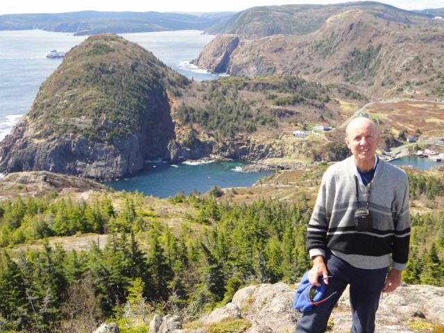
ECT km 100: David with Quidi Vidi Village behind
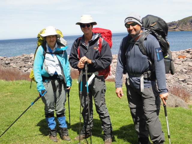
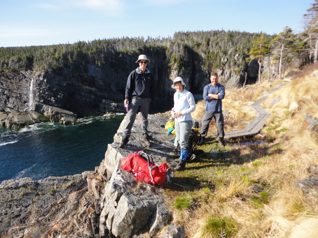
ECT km 106: Barbara, Evan and Bill near Freshwater Bay
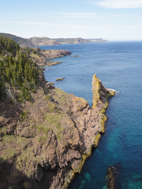
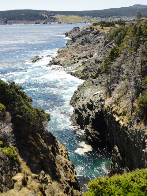
ECT km 110: Coastline near Blackhead Bay
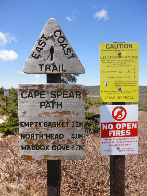
ECT km 116: Typical ECT signs near Cape Spear Lighthouse
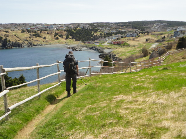
ECT km 125: Maddox Cove
On Saturday 19 May (long weekend) there was frost on the tents when we set out at 7.00am. This day we saw quite a few day hikers and the “official” ECTA campsite at Little Bald Head km 147 near the Spout was quite full.
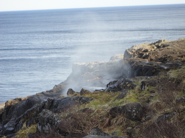
ECT km 146.5: The Spout at Little Bald Head
However, David and Barb continued backpacking south. Further details of their private trip can be found under my trail name “notdeadyet” at http://www.trailjournals.com/index.cfm
C, S & P by David.
Participants: David,Bill,Barbara,Evan