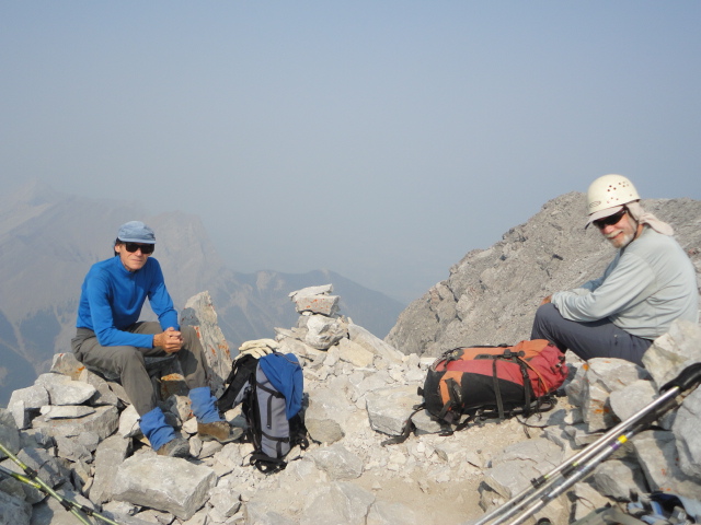
Manfred and John relax on the summit of Big Sister: Very smoky (Mt. Lawrence Grassi behind Manfred)
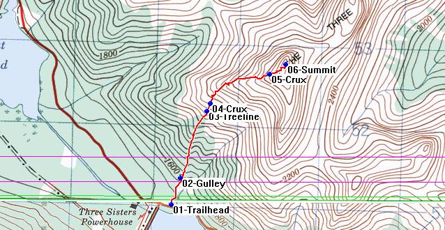
Big Sister Route
For the descent, we initially followed the ridge but then swung into the gully gravel to skier's left before regaining the ridge just above a steep 2 metre cliff that we had hoped to avoid. However, good handholds made this surprisingly easy (when you had found the holds). Below treeline we found another well trodden dirt trail to skier's left which we took. This trail led into the gully and eventually back to the cars, but it was very steep in places. Probably the more solid ridge would have been better both for the complete ascent and descent. It was now 5.10pm and my car thermometer read +28c. As planned, I stopped in Canmore to take in the presentation at the monthly ACC meeting (got little out of it), while the others drove back to Calgary.
Stats: 6km, 1200m elevation gain, 8 hours. When dry, this was a steep scramble on fairly good rock with some exposure, with potential for excellent views. Best to stay home if wet or snowy. Jim's enclosed GPS map from 2005 shows the essentials. Thanks to Manfred and John for joining me C&S David.