It would have been a perfect summer day except for the smoky haze obscuring the views.We followed the good trail to Bow hut ,a few stream crossings presented no problem.
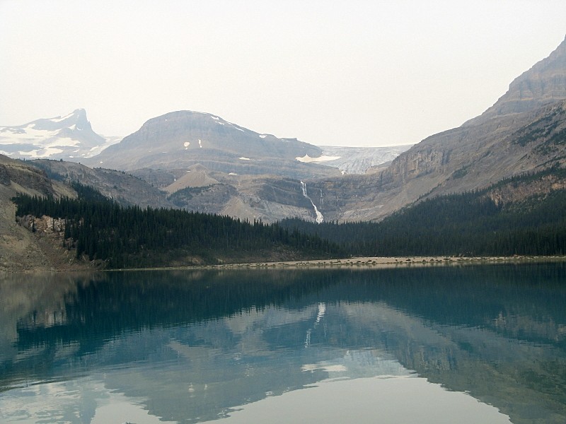
Bow lake with the Onion on ctr.
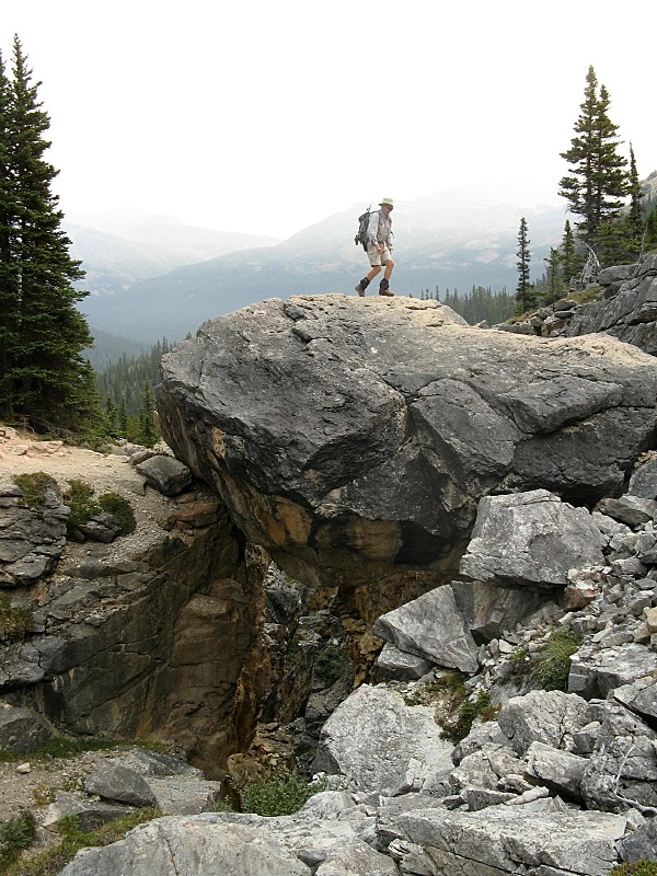
Phillip crossing the chokestone
Just before the hut we opted to go left ,close to the cliffs, eventually this route joins the more direct but less scenic one coming from the Bow hut
You slip,you go for swim
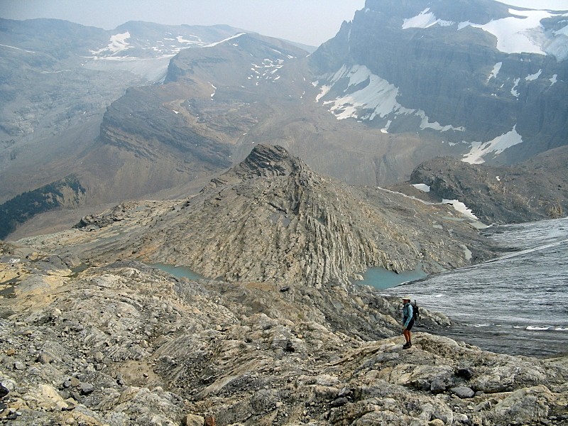
We stopped for a break at the twin tarns at the base of the Onion summit bloc
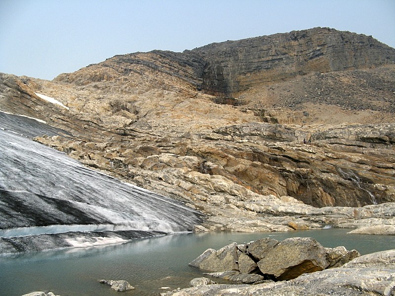
Glacial tarn at the base of the Onion
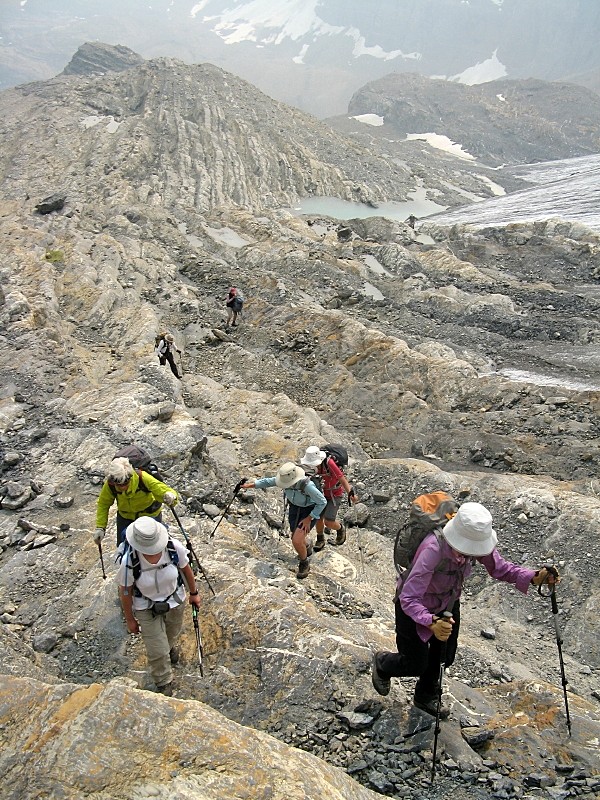
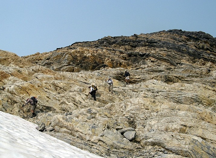
It was easy to make our way up transfering from ledge to ledge wherever it was easier to do so
Climbing up the layers
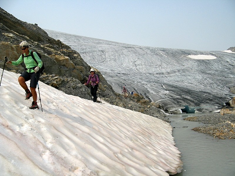
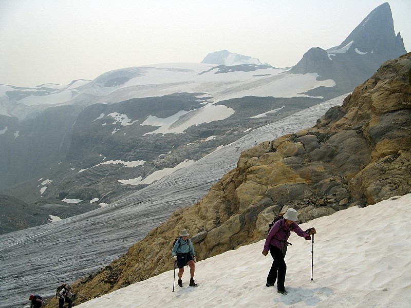
A patch of firm snow. . Pointy St. Nicholas in bkg.
Surprisingly the summit is a large plateau , great views to the Wapta icefield whit lofty summits poking out of the ice.
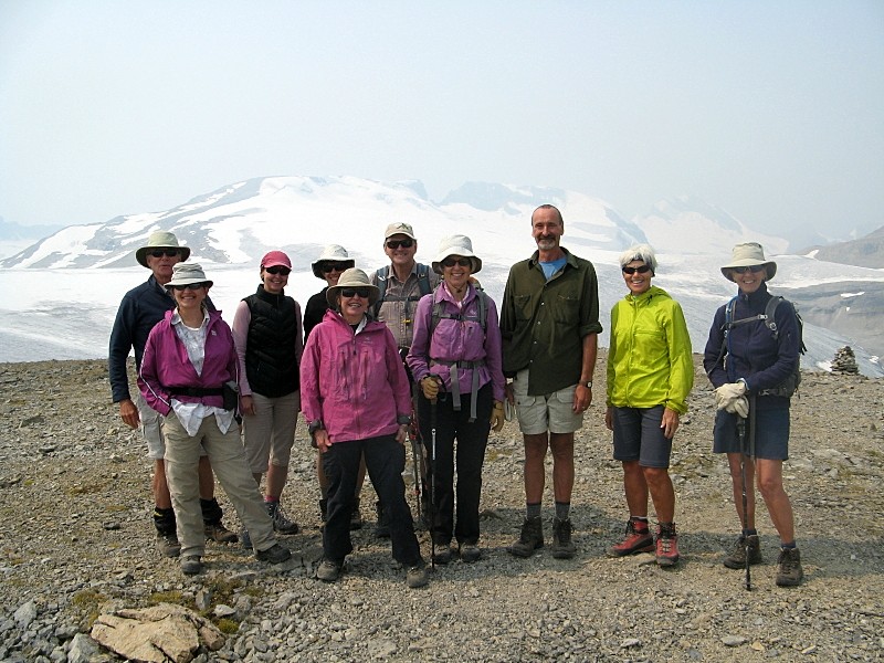
Happy group on the summit
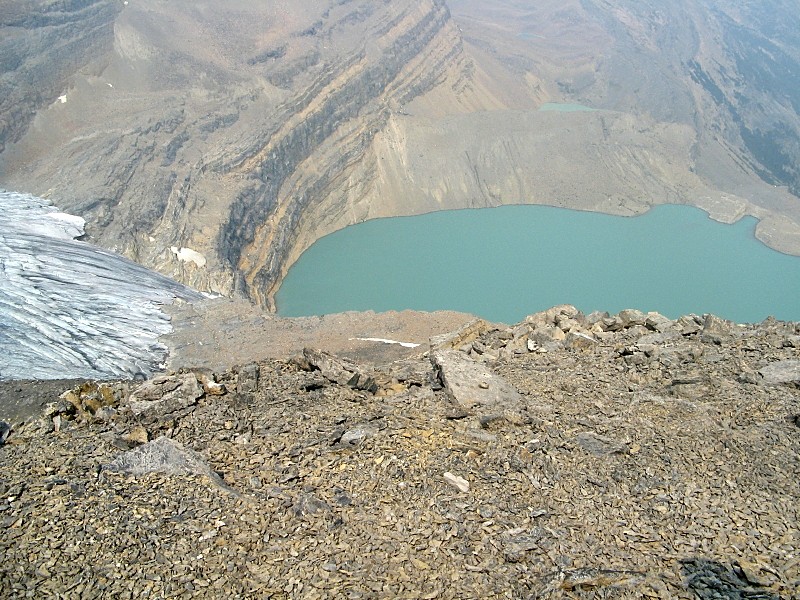
Birdseye view of Iceberg lake.Eventually some of its waters will be flushed down our toilets
After a long break we retraced our steps reaching the cars at 5:30.
Retracing our steps
Supereasy scrambling down the onion layers
Ascent time 3:45 hr / descent time 3:30 hr. Thanks to all Participants: Rosanne,Philip,Alda,Cordula,Jeannette,Zorica,Sonja,Harold,Katrin for joining me in a succesful ascent of a peak new to all.Francisco C/S
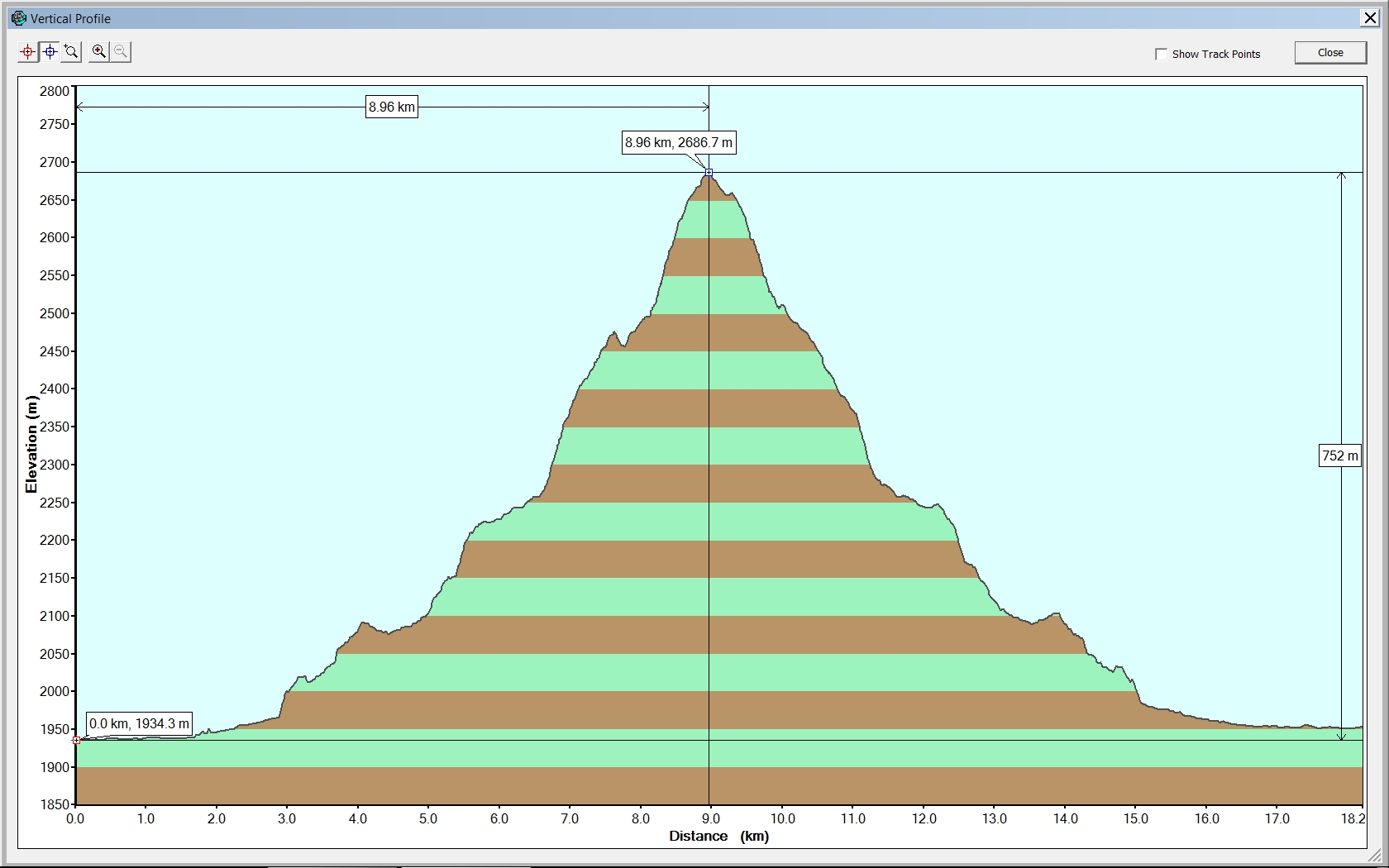
The Onion Elevation Profile, Statistics: distance 18.2km, Elevation Gain 752m
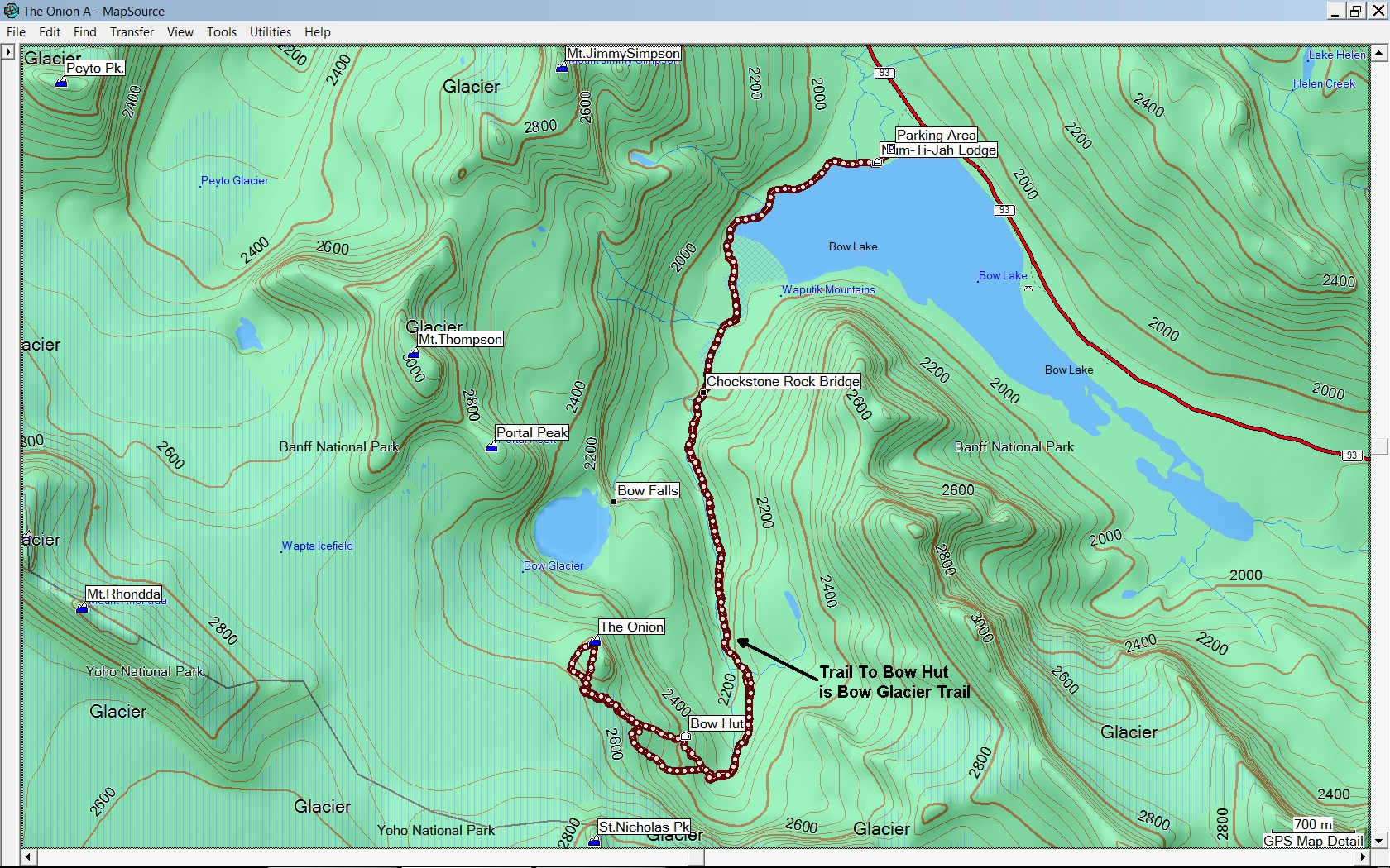
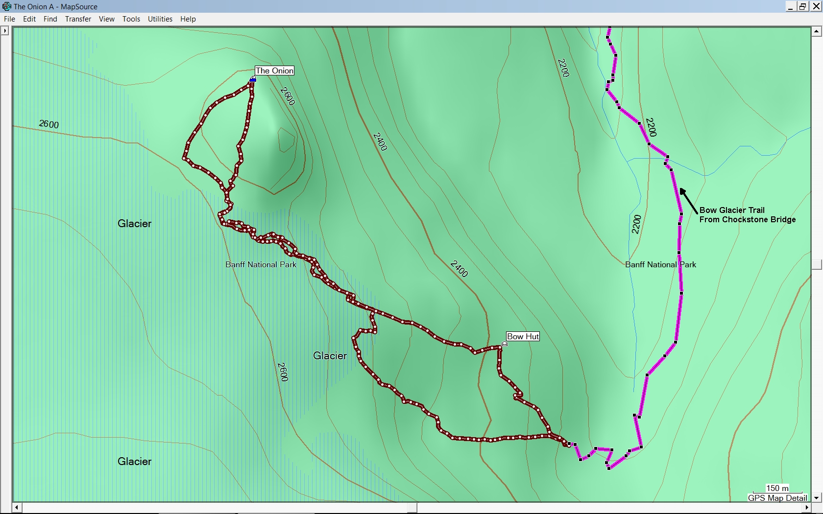
GPS Track for Overall Trip Bow Lake > The Onion
GPS Track Detail Bow Hut > The Onion, Slightly different Route Up and Down