It was a new trip for many of the participants. The Ribbon Creek trail has under gone a major rebuild with some re-routing to higher ground.
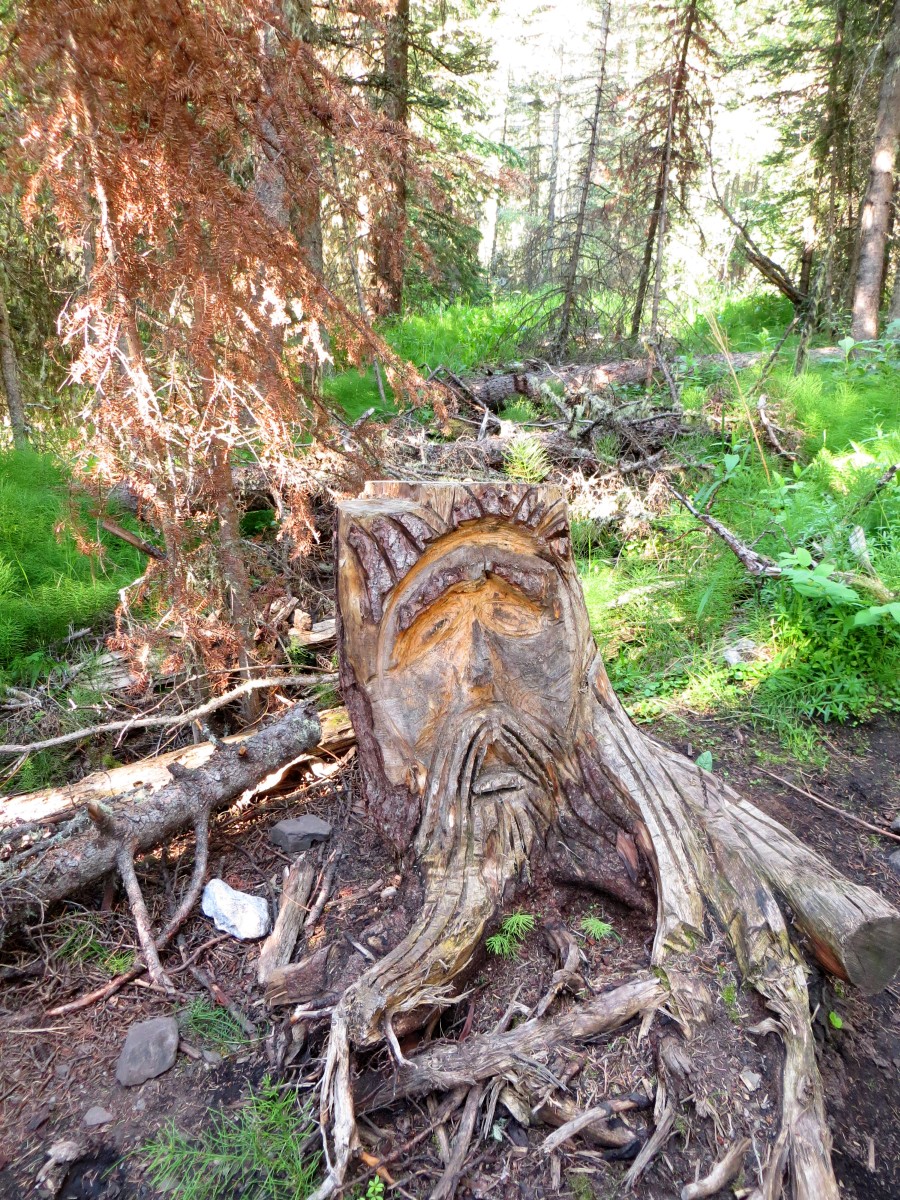
The Guardian of the Trail, Still Standing Guard
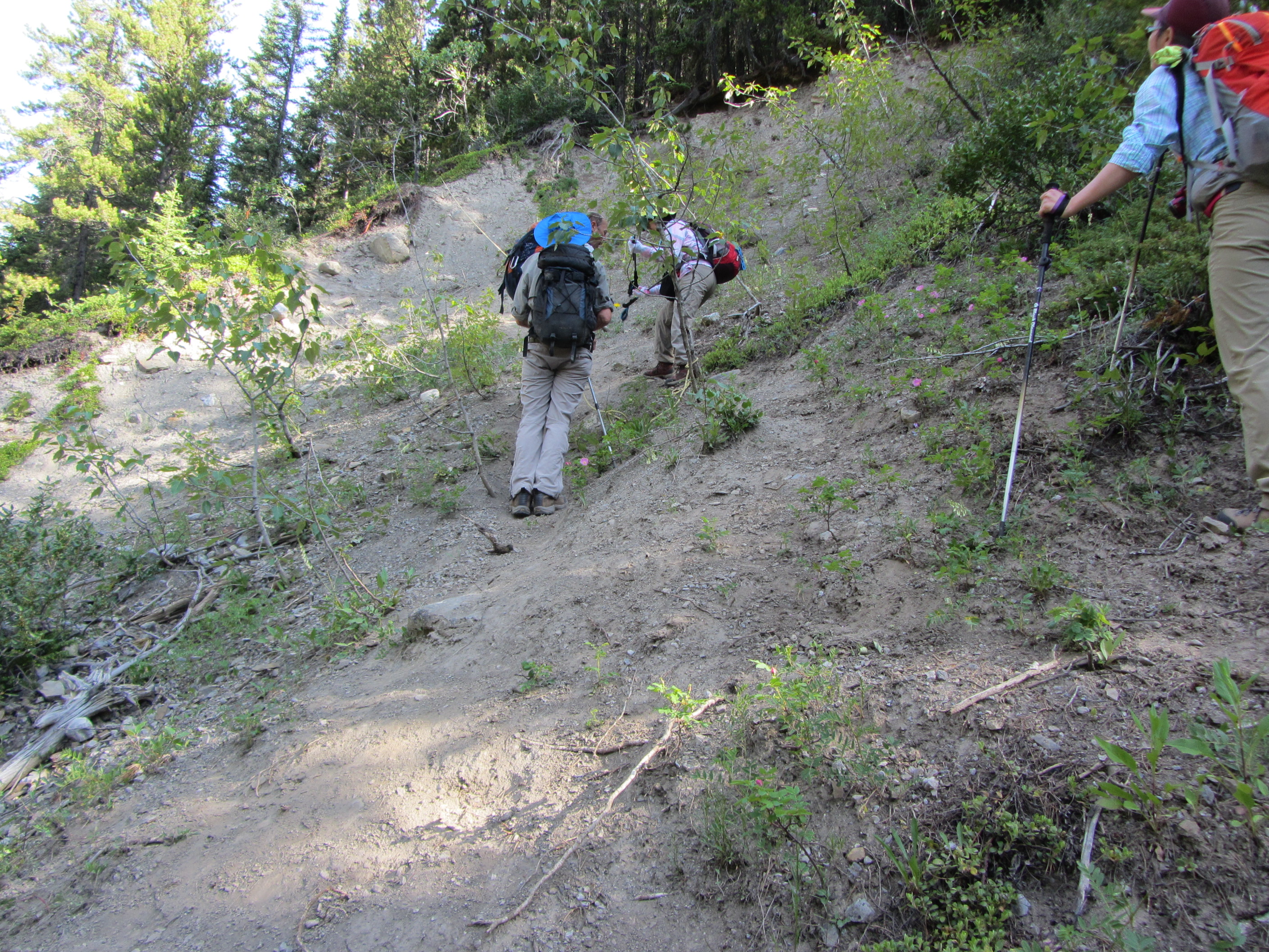
Although significant portions of the original Memorial Lakes Trail are intact there are are a few areas where it has re-routed away from North Ribbon Creek. Two areas on the north side of the creek, which were always bad due to a slope collapse, have gotten worse. These two areas are about 570m ~ 670m from the start of the Memorial Lakes Trailhead. The first can be easily avoided if you turn Right and go High at about 374 m from the start of the Trailhead. This area to be avoided (Avoid 1) is shown in red on the map and in the photo.

This is the Avoidance 1 noted in (Red) in the GPS Track and Narrrative, This you can Avoid.
The second problem area presents another steep collapsed slope. This is shown as 2a in yellow on the GPS track.
This is the 2a Avoidance noted on the GPS Tracks and Narrative, Hard to Avoid, Rope Supplied by Others (click photo to enlarge)
The trail to the falls and the first lake was on trail with a few new creek crossings. We had a short stop at the falls and then proceeded to the first lake.

The Waterfall
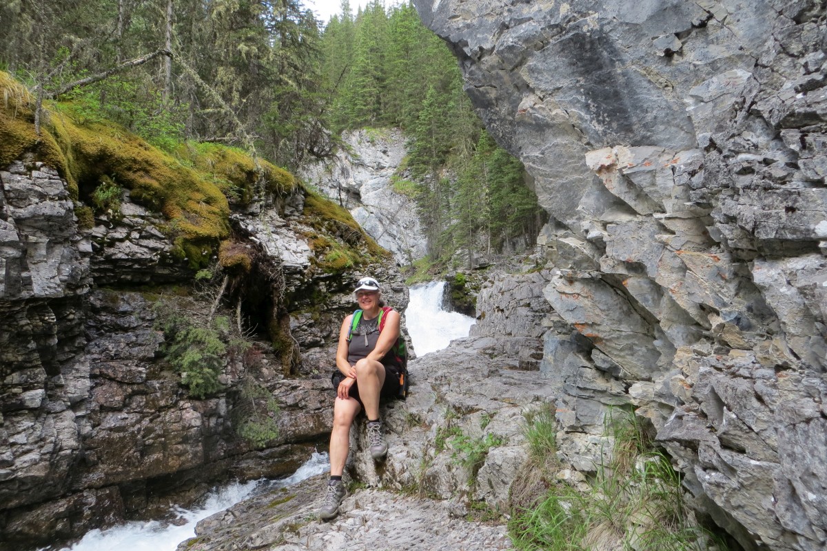
Teresa cooling off at the Waterfall
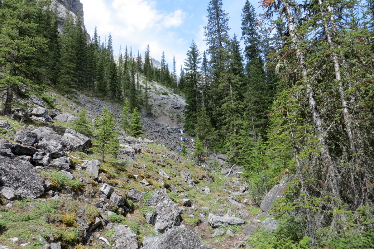
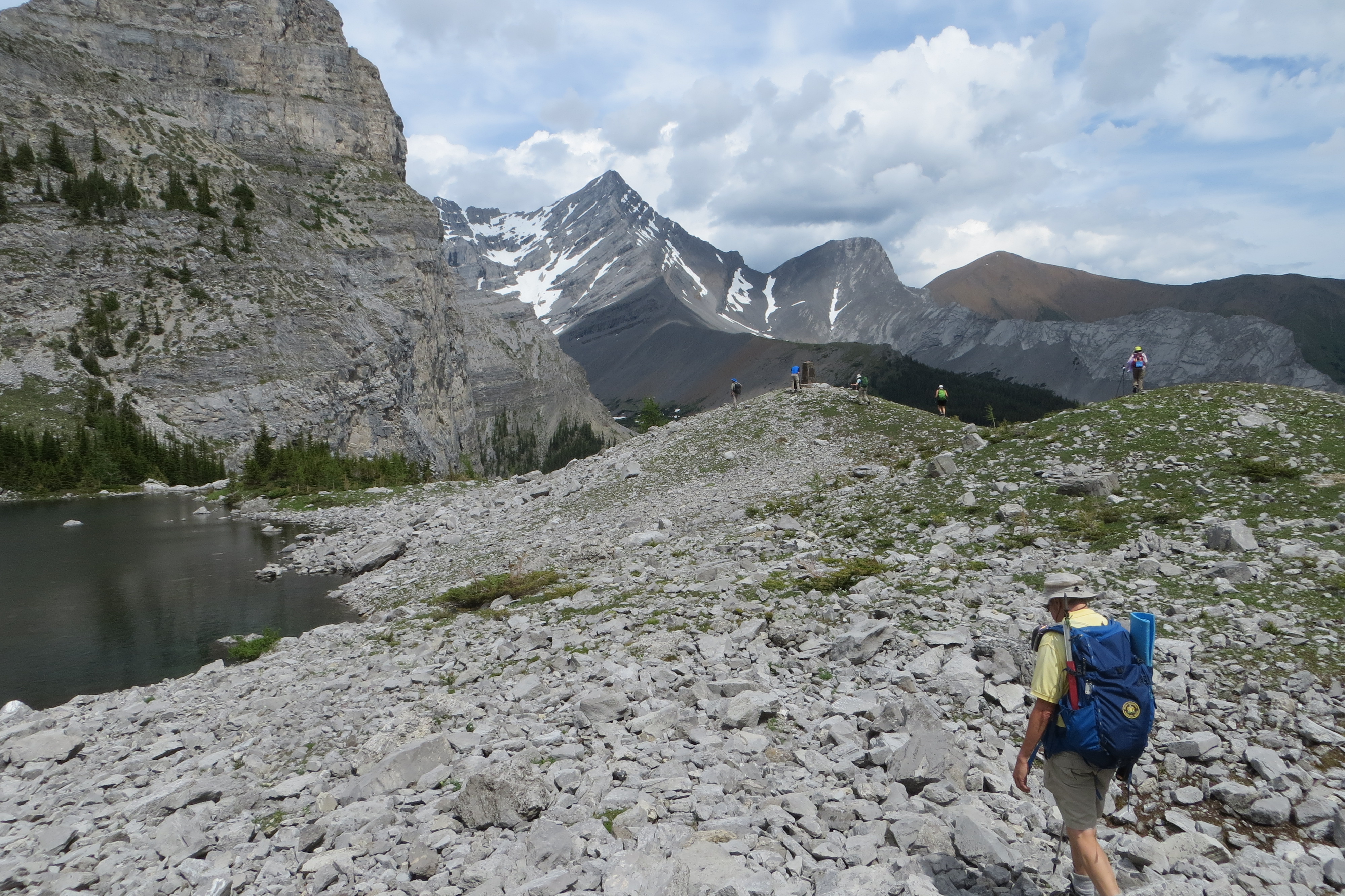
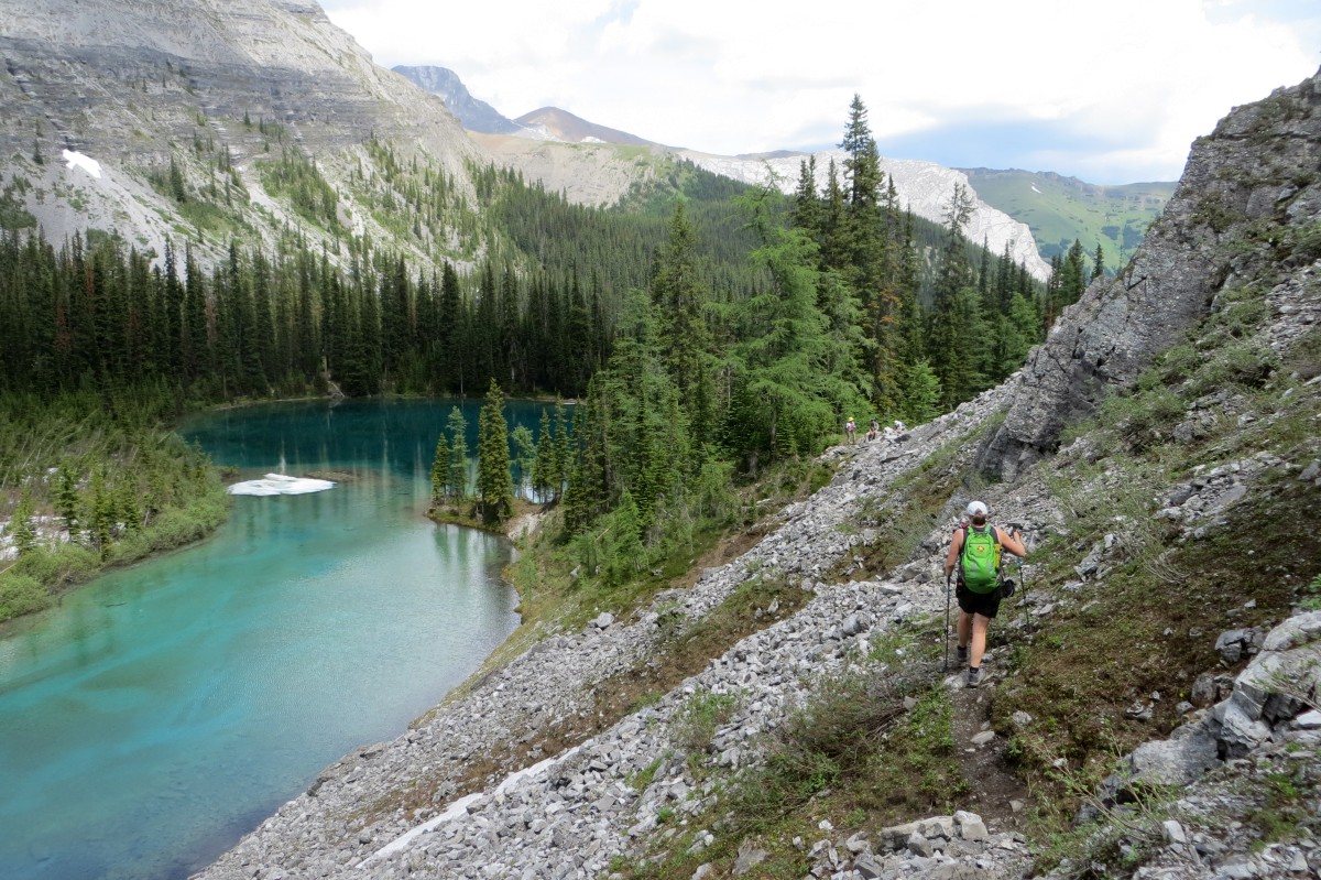
The drainage and scree slope up to the Second Lake
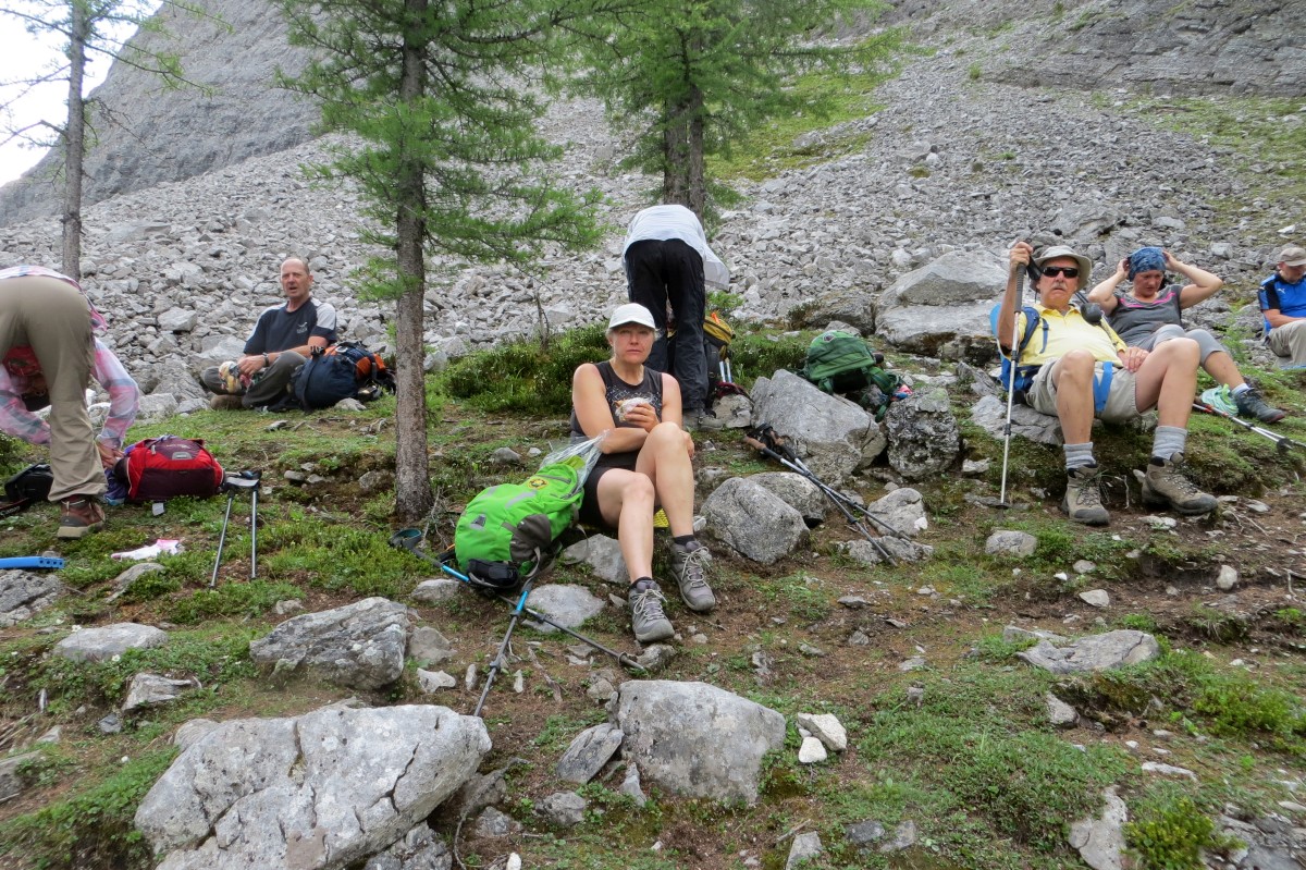
Break at the Second Memorial Lake
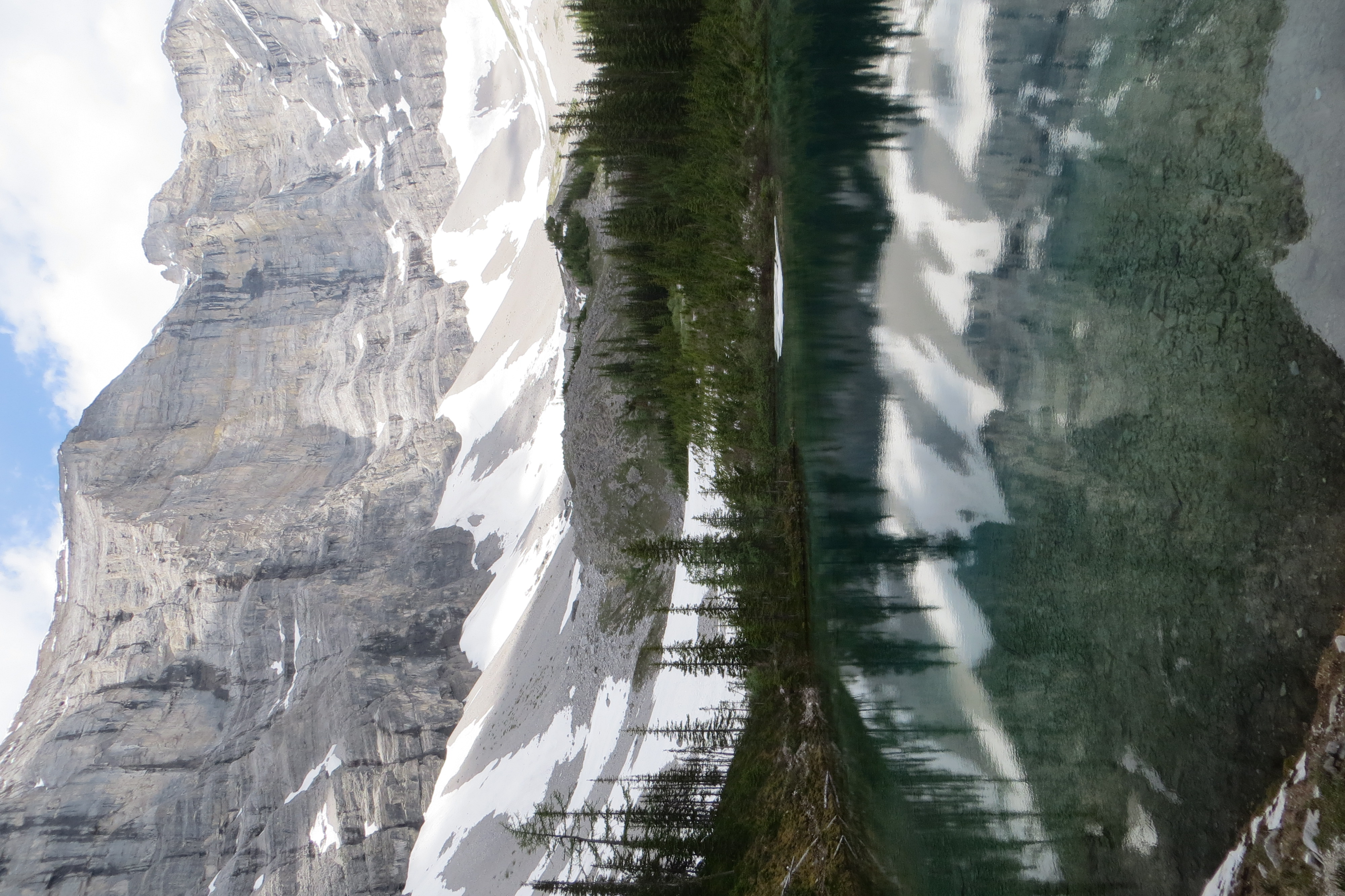
View of Second Memorial Lake
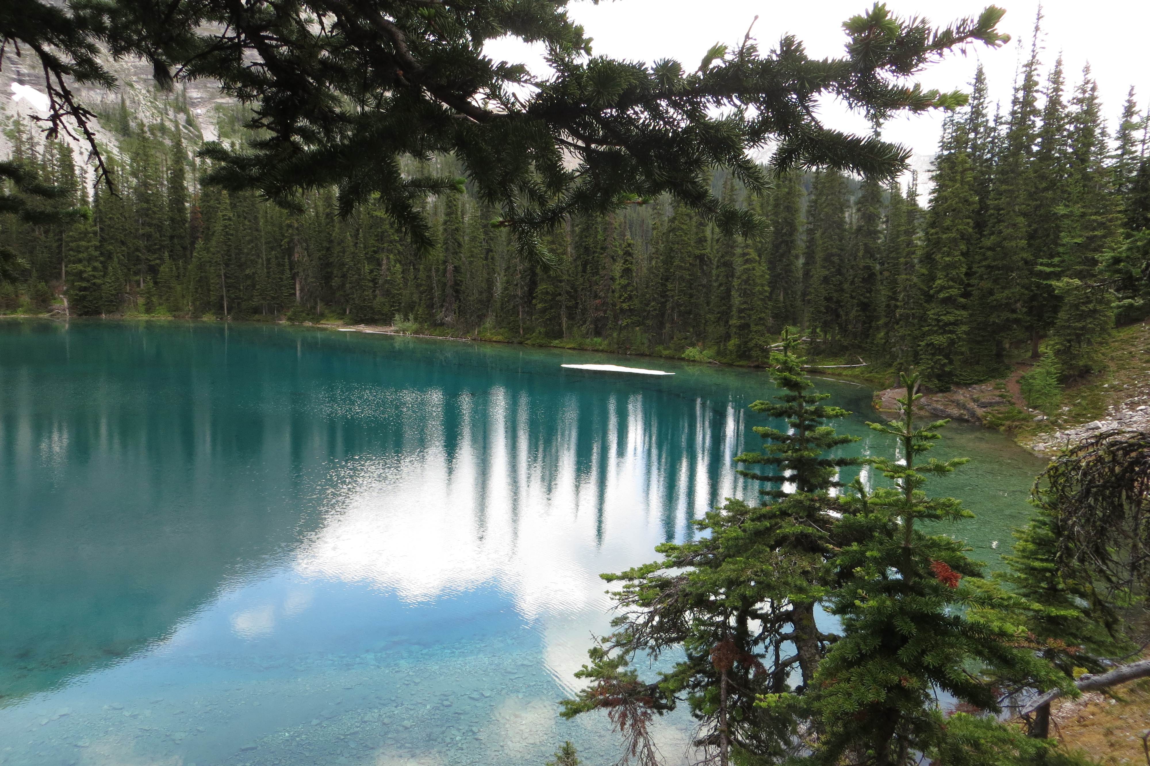
Going Around the Second Memorial Lake
A few others proceeded along the wall where a rough scree and rock ridge ascent accent route was available as an alternative to the scramble. We all took this route down.
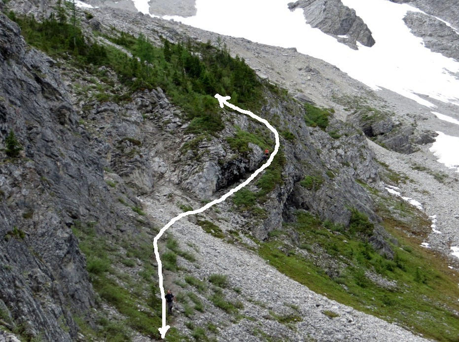
Alternate non Scramble route up/down below the third lake
We dropped down to the third lake circling counterclockwise and had a much deserved lunch at the Memorial.
Making our way to the Memorial
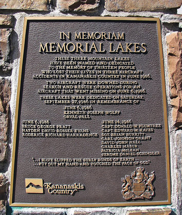
The Monument Plaque
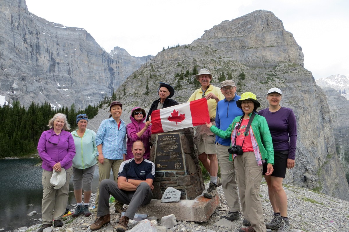
Group Photo at Third Memorial Lake
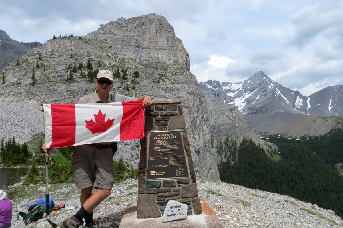
Your Co-Ordinator
We left the third lake circling counterclockwise up a visible scree trail to the left of the Bogart Tower. This route appeared to be shorter and less elevation gain to get out of the basin of the third lake.
As mentioned we all took the alternate non scramble route down to the second lake. --invalid photo25943--
After a brief regroup we made our way down the rock and scree slope to the first lake and on to the waterfall for a rest break and more photos..

Another Group Photo at the waterfall
Down to the Second Lake to Re-Group
Descending further we tried to bypass the second avoidance by using Teresa's route but mixed reviews on that one. The first avoidance was easily bypassed by using the higher route down.
The group made it back to the parking lot in 8 hours and 51 minutes car to car. I thought this was pretty good considering the extra route finding we encountered.
Hike length was 18 km, elevation gain of 765 m.
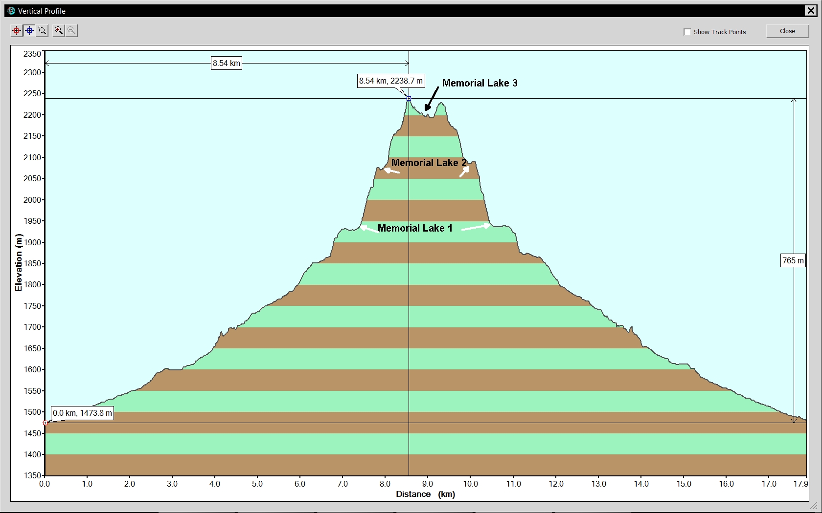
Memorial Lakes Trail Elevation Profile
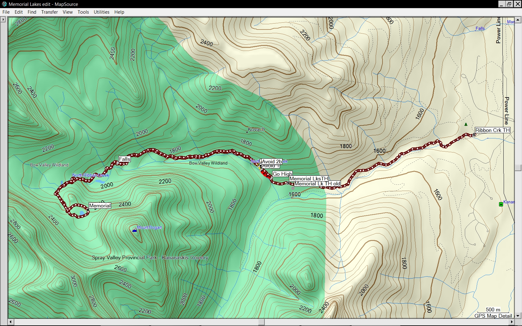
Memorial Lakes Trail GPS Track

Close up of what to avoid (red) and what to be cautious of (yellow)
It was also personal improvement of a whole 3 minutes over when I did the trip 10 years ago.
Thanks everyone for a great Canada Day!
Participants: Joe, Ron, Terry, Jeannette, Janice, Teresa, Jane, Ross, Suzy, Mikako and Harold