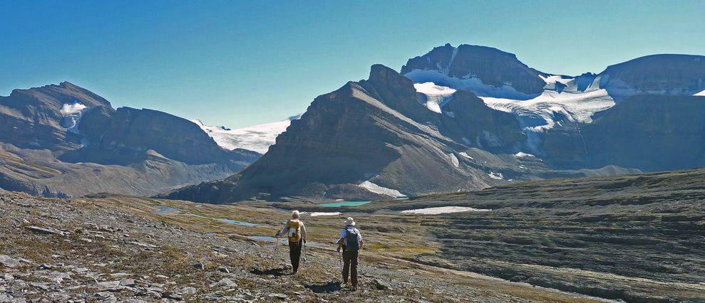
Caldron Lake is stunningly beautiful, the views were stunning from the top of Caldron Peak, and the water in Peyto Creek stunned our feet! But we were able to cross the creek in no more than knee-high water.
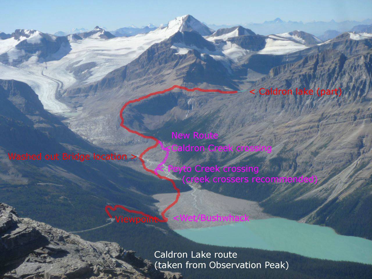
This is a longish trip so we met at 6 and were at the Bow Summit Trail head by 8:30. From the Peyto Lake viewpoint we could see most of the route to Caldron Lake and also plan our route now that the bridge across Peyto Creek is gone (and will not be replaced).
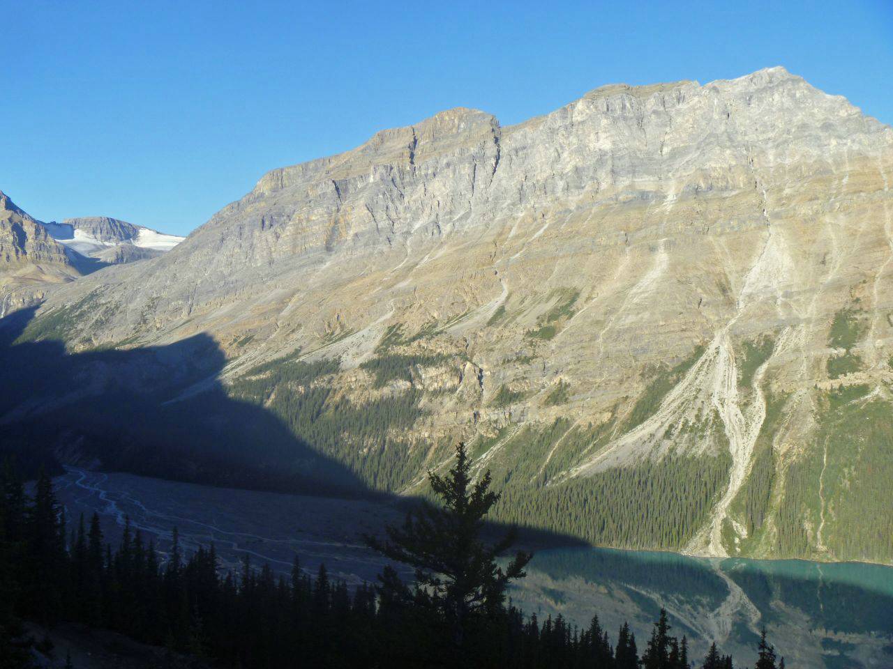
Caldron Peak from Peyto Lookout (at Bow Summit)
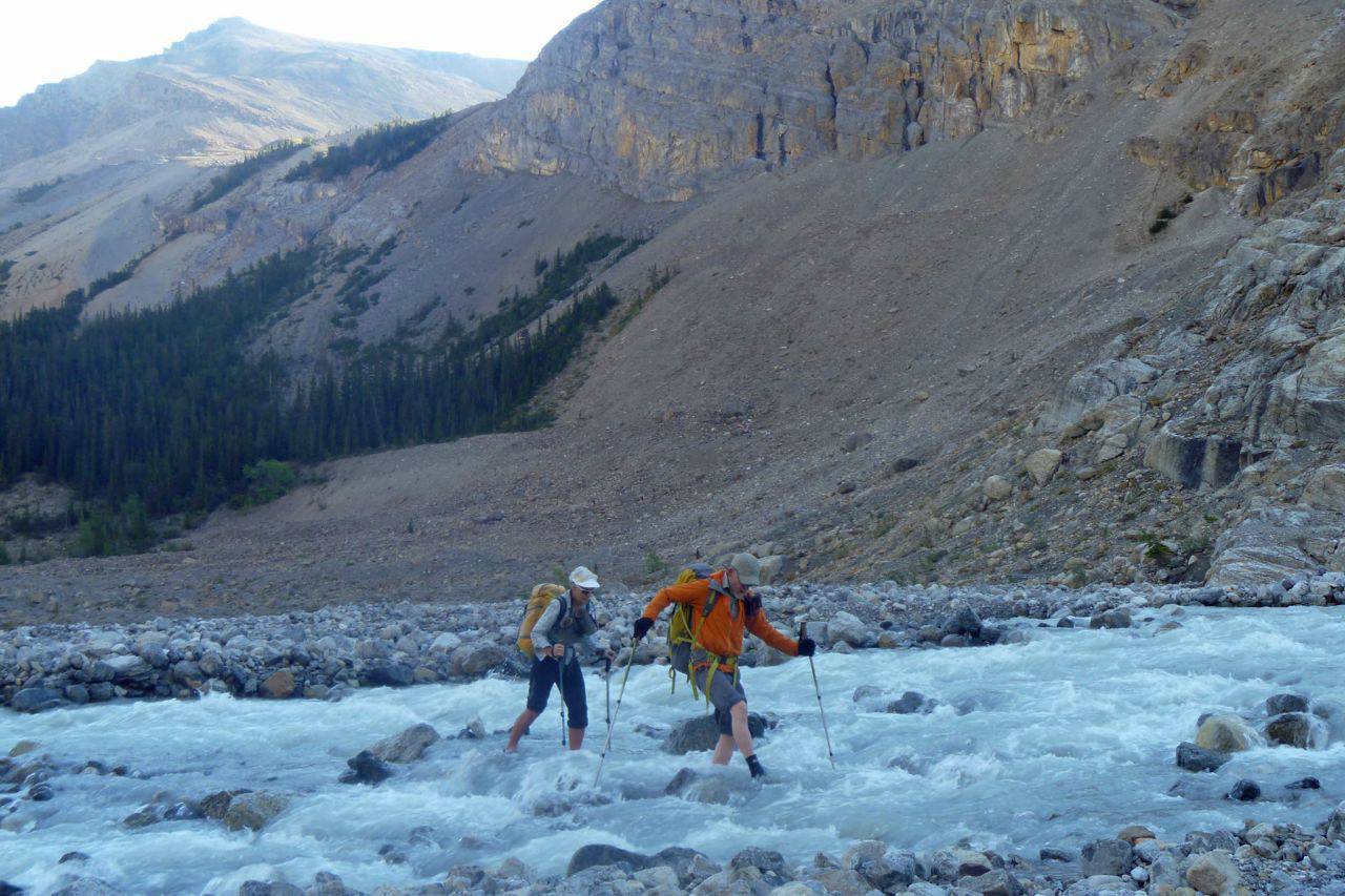
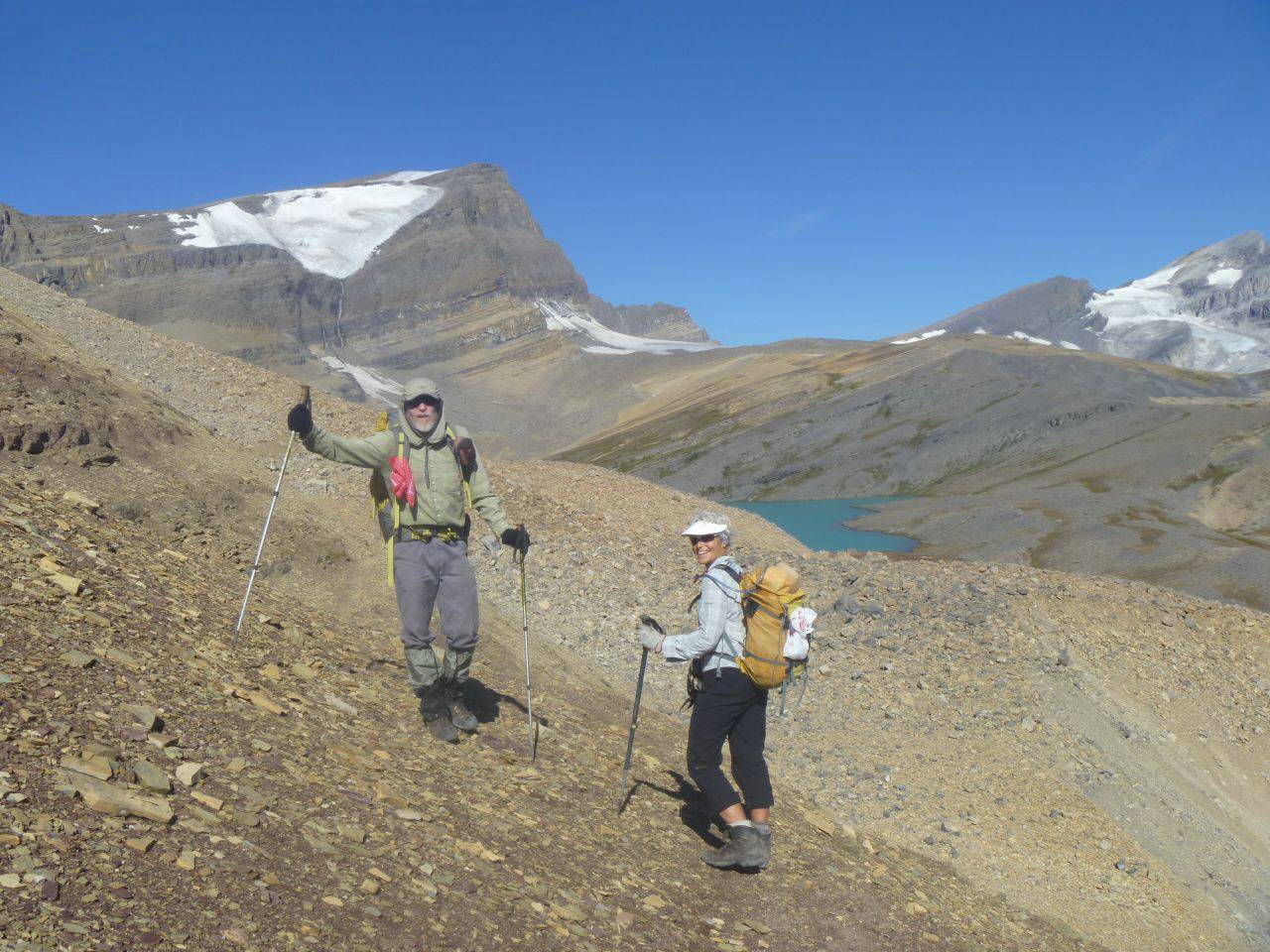
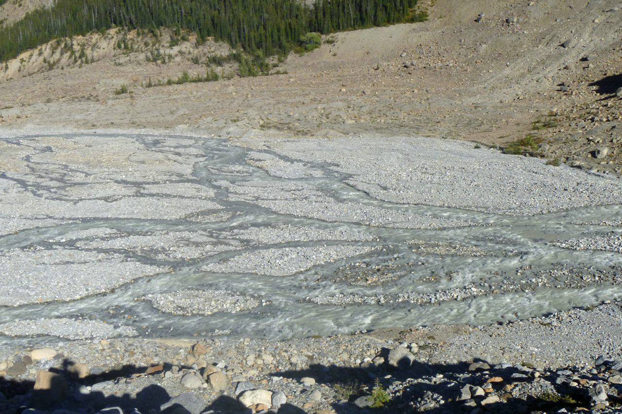
Below the bridge location the creek is quite braided, it narrows down through a gap in the rock and then is very braided down by the lake. We decided to do the logical thing and follow the old route to the upper braiding, then cross there and make our way up (also crossing Caldron Creek) to the moraine where we would pick up the trail again. The first "crux" was at the bottom of the descent from the viewpoint down to Peyto Lake. The creek has cut new channels right by the slope and so one has the option of getting wet or a bit of bushwhacking for 100-200 m. After that we crossed the lower flats and picked up the trail as it makes it's way over and around the narrowing to the upper braided area. We looked around quite a bit to find the best spot to cross and in general elected to cross many shorter shallower "streams" rather than at the points where the water is deeper and faster. In the end we probably managed to not go higher than knee deep but out feet were pretty cold after six or so crossings and some back and forth on the cobble flats to find the best spots. Creek crossing footwear seems to be an absolute neccessity.
Fording a very cold Peyto Creek
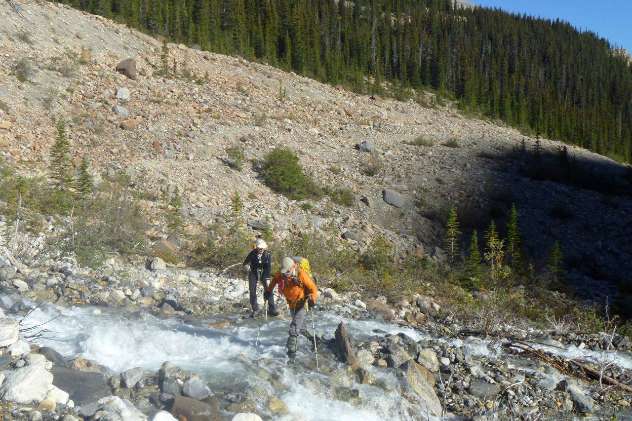
We then put our boots on and followed cairns that took us up to the old trail on the very obvious moraine. We chose to do some scrambling but one could definitely keep it to OT4 of one wanted. One does have to cross Caldron Creek a little higher up but we managed that reasonably without changing footwear.
Fording the smaller Caldron Creek (with boots on)
Back on the original Caldron Lake trail two of us left our creek crosser and we headed up to the lake.
Back on the original trail to Caldron Lake
There is still a part of this route where it crosses a steep slope on narrow trail and where a slip would be extremely serious. The slope descends to a large chasm. I guess that was our third or fourth "crux". Shortly after that the spectacularly beautiful Caldron Lake comes into view.
First views of beautiful Caldron Lake
We took a longish break at the lake and prepared to continue on to the summit. From the lake, only the lower south summit is visible It is necessary to continue on to the Caldron/Mistaya col before the true summit and the various routes up to it are visible. W picked different routes up, Alda's route was definitely better and faster, Arnold and I stayed to the right close to the rock bands below the south summit hoping for less loose material but had a lot more trouble. In any case there are many ways up that avoid any scrambling but it is still a lot of loose rubble, OT 4/5 in Rambler terms. The summit is about 560 m above the lake. And what fantastic views it affords!
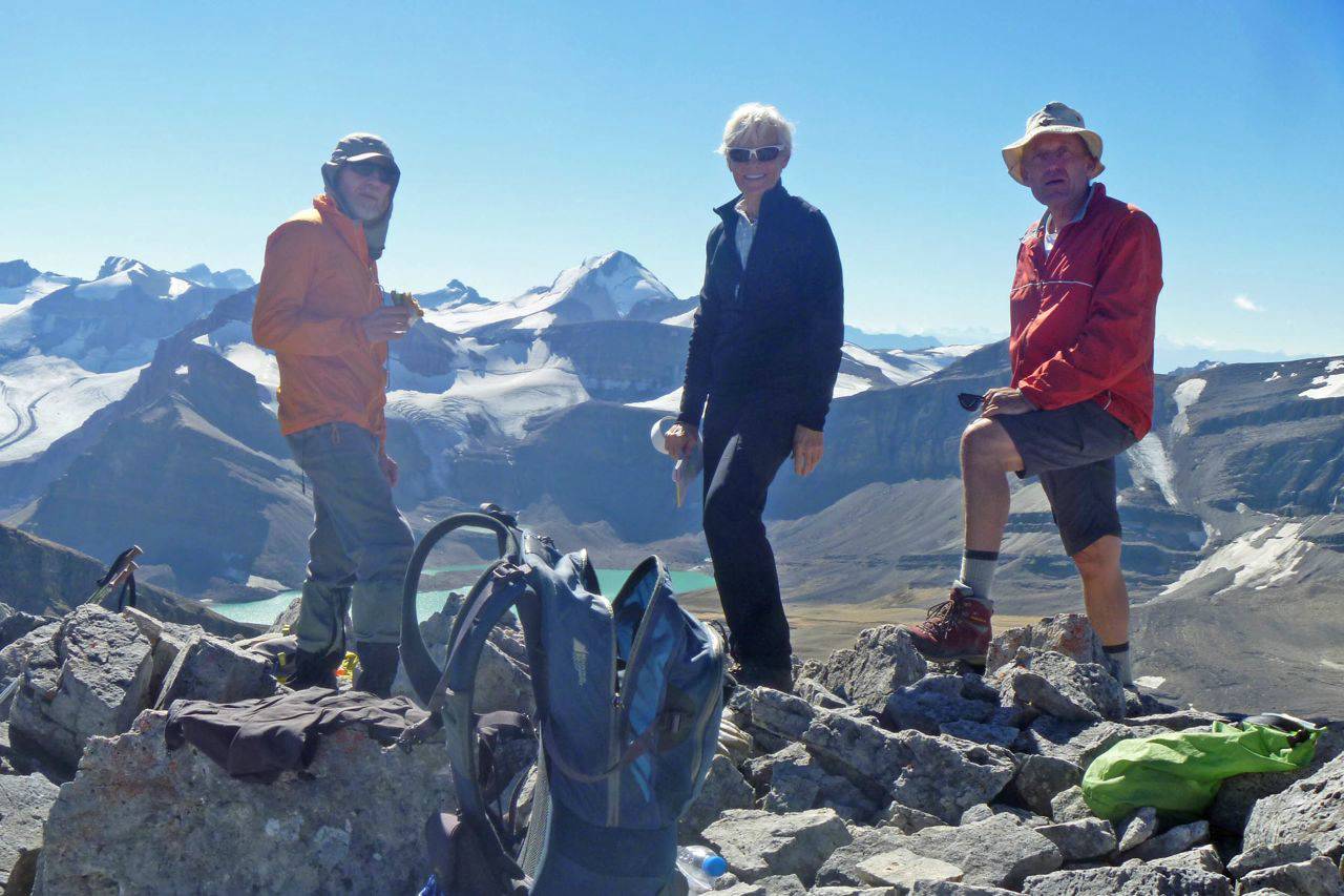
Arnold, Alda and Carl on Caldron Peak
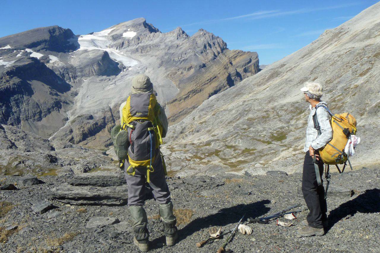
Looking for a route up Mt Patterson
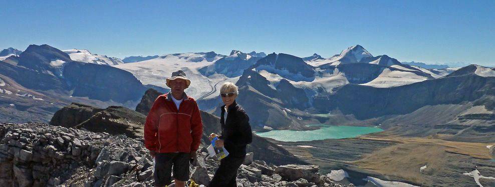
Panorama from Caldron Peak (Thompson at left, Baker at right, Caldron Lake below)
We spent a good time at the summit, mostly examining peaks in all directions. Much of the Wapta is close by, the Freshfield Icefield to the west, many peaks in all directions. After we had had our fill we headed back down.
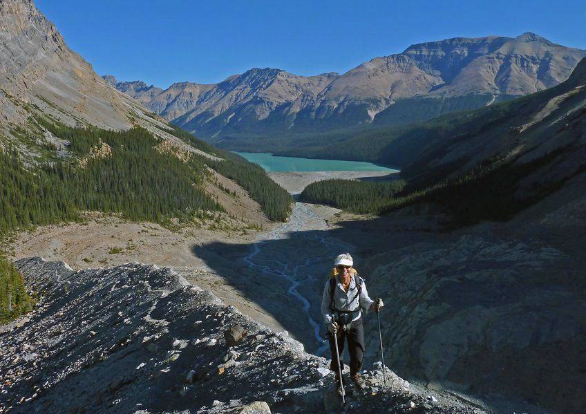
Returning to Caldron Lake
This photo shows the braiding that we crossed.
Braided Peyto Creek below the old bridge location
Our next crux was our creek crossers, they were gone. We looked around thinking that animals must have taken a liking to them. After a bit we gave up and started down without, dreading crossing without. Then up ahead we spotted a lone hiker carrying two pairs of shoes! We called to her and she waited for us. She really didn't have any explanation why she had picked them up but it didn't seem like she had wanted to "steal" them. In any case we headed down with her, but lost her when we put on our creek crossers. She had made it across without going over the top of her boots in the morning but did go in knee deep on the way back. The water did seem to be higher or we were less picky/skilled in picking our route back and we all got knees and rolled up pants somewhat wet. We managed better around the edge of the lower flats and then had the tedious climb up the trail back to the viewpoint. The weather was fabulous other than being a little chilly (5 c) in the morning, we were about 10 1/2 hours car to car. The elevation gain is about 1100 m from Peyto Lake to the Caldron Peak summit and one then has the 275 m to climb back to the viewpoint at the end of the day.
Many thanks to Alda and Arnold for joining me, Carl (C/S).
PS Alda and Carl climbed Observation Peak, right across the highway, two days later. From there I took the following photo showing our route.